Tomer’s Take:
- Storm #2 is currently generating snow and strong wind in the PNW, ID, MT, WY, and UT.
- Storm #3 is riding the jet on the heels of storm #2.
- Overall, the atmospheric river (AR) intensity remains in question for the Sierra. It looks brief and weak. I decreased snow totals a notch in CA.
- Snow totals still look big for the Interior Rockies.
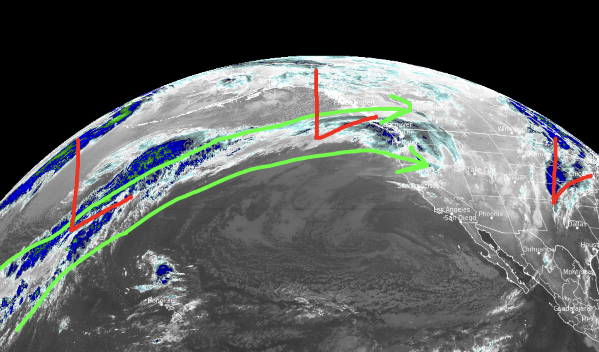
Current Setup
Infrared satellite shows the storm track and moisture funnel with associated Integrated Water Vapor Transport (IVT).

Snow is currently falling at Jackson Hole. This is from storm #2. Big totals are likely from the two storm combo with a break in the action in-between (on Sunday).

Brighton, UT is reporting new snow with more on the way.

Strong Wind
In Colorado, I’m forecasting a blend of snow showers shrouding the Central and Northern Mountains plus strong winds 50mph+.
Forecast: Strong wind + snow showers.
| Longs Peak | MPH |
| 11/5 | 75 |
| 11/6 | 40 |
Forecast: Strong wind + snow showers.
| Quandary Peak | MPH |
| 11/5 | 50 |
| 11/6 | 40 |
Forecast: Strong wind + snow showers.
| Bierstadt | MPH |
| 11/5 | 65 |
| 11/6 | 50 |
November 5-11
Forecast jet stream flow delivers strong wind and brief weak atmospheric river (AR) contributions to CA’s Sierra.
Valid 11/7.

Forecast jet stream 11/8.
This is a good pattern for Utah and Wyoming.
The intensity of the AR for the Sierra is still in question.

Forecast jet stream 11/9.
The low tracks north of Colorado. This is not optimal for big snow in Colorado. And, it will be windy.

Forecast Timing
Forecast radar/satellite valid 11/5-11/10.
Forecast Snowfall
Forecast snow totals (inches) valid 11/5-11/6.

Forecast snow totals (inches) valid 11/7-11/12.
Left: My AM update Sierra snow forecast.
Right: My PM update Sierra snow forecast.


My forecast video 11/5: Includes updated snow forecast numbers for the Sierra:
I have a short term memory. Every once in a while would you re-post the legend for the colors? Thanks a million.
Thanks, Colleen, I’ll try to locate a legend. Chris
At BanffSunshine be got about 11 inch as of 5:00pm this afternoon Nov 5th.. snowing lightly as of this note 10:00pm….yea we are pumped…..
Fantastic, Jim! Chris