Water temperatures in the Equatorial South Pacific are running about 1.0C colder than normal. The latest forecast calls for water temps to stay colder than normal into Summer – through June-July-August.
The blue bars in the graph below represent La Nina.

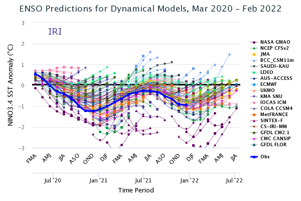
Here’s a look at the model spread over time. We’ve been locked into La Nina since Summer 2020. The zero line represents ENSO-neutral.

Impact to the West
Through Summer: STATUS QUO

Hail and Tornado risk tends to be higher March-May with La Nina.

Beyond Summer
What phase will we see for next Fall?
The odds remain highest (40-50%) for a Neutral Phase.
What does this mean for summer monsoon in Colorado?
Hi Tim and Carrie – La Nina tends to reduce the intensity of the Summer Monsoon across the desert SW. Chris