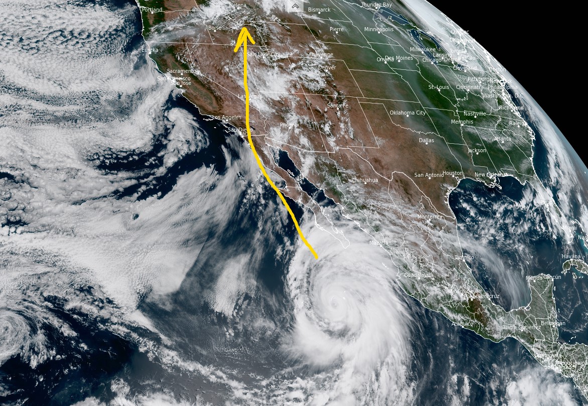
Tomer’s Take: The remnants of Hurricane Hilary could impact many of the high peaks across the West 8/20-8/21 with strong wind and precipitation including very heavy snow on some California 14ers. This assumes the storm system stays on track.
Below, the visible satellite view from GOES-18 shows Hurricane Hilary. I drew on the projected path.

High Peak Impacts
Mount Whitney, CA.
| Summit Level | Gusts | Snow |
| 8/19 | 40mph | PM 1-3″ |
| 8/20 | 60mph | 1FT+ |
| 8/21 | 45mph | AM 1-2″ |
Thunderbolt Peak, CA
| Summit Level | Gusts | Snow |
| 8/19 | 25mph | Late 1″ |
| 8/20 | 30mph | 8-16″ |
| 8/21 | 30mph | AM 1-2″ |
Kings Peak, UT
| Summit Level | Gusts | Precip |
| 8/19 | PM 35mph | PM Rain |
| 8/20 | 60mph | Dry |
| 8/21 | 75mph | PM |
Grand Teton, WY
| Summit Level | Gusts | Snow |
| 8/19 | 30mph | PM 1-3″ |
| 8/20 | 30mph | PM R/S |
| 8/21 | 50mph | Dry |
Boundary Peak, NV
| Summit Level | Gusts | Snow |
| 8/19 | 30mph | Late |
| 8/20 | 25mph | 6-14″ |
| 8/21 | 45mph | AM 1-3″ |
Granite Peak, MT
| Summit Level | Gusts | Precip |
| 8/19 | 35mph | PM R/S |
| 8/20 | 50mph | Heavy R/S |
| 8/21 | 60mph | Drier |
Love the info, that’s why you’re the MVM!
Most valuable meteorologist!
Thanks, Randall!