Tomer’s Take:
- A series of cold fronts deliver colder air and snow accumulation above treeline Friday, Saturday, and Sunday in Colorado.
- Below treeline precipitation stays rain.
- Snow accumulation is possible in all mountain zones above treeline.
- Some of the biggest totals might occur in the San Juan Mountains.
- Air temps in the mountains will gradually drop each day.
- Monday-Tuesday (10/3-10/4) look even colder with continuing snow chances.
10/1 Update: October snow! Loveland Pass–>

Current Setup
Water vapor satellite shows a low pressure system and cold front sliding through Utah, Wyoming and into Colorado. Red/orange = drier air aloft.

Mountain Forecast
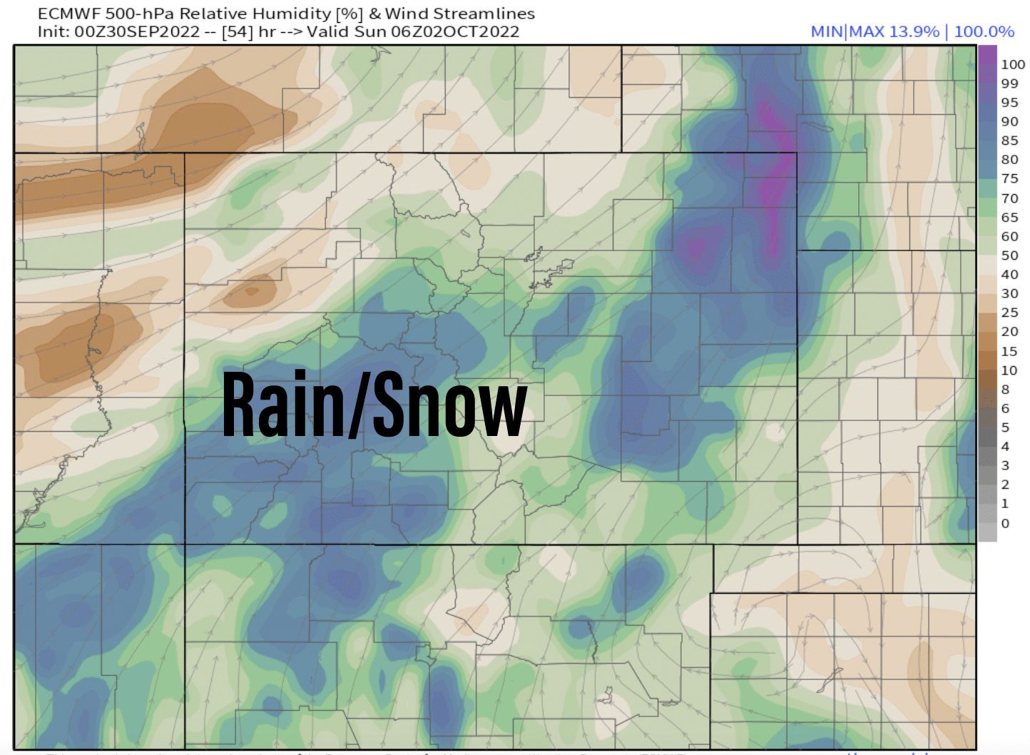
Atmospheric moisture this weekend will be running high. Rain is likely at lower elevations with snow above treeline. Here’s humidity mid-troposphere valid 10/1-10/2.

Monarch Pass and Above
| Snow Chance | AM | PM |
| 9/30 | Dry | 50% |
| 10/1 | 30% | 80% |
| 10/2 | 20% | 80% |
| 10/3 | Dry | 70% |
How much accumulation? Possibly 1-2″ each afternoon/night above treeline.
Mount Sneffels and Above
| Snow Chance | AM | PM |
| 9/30 | Dry | 20% |
| 10/1 | 60% | 100% |
| 10/2 | 100% | 100% |
| 10/3 | 10% | 100% |
How much accumulation? Possibly 2-4 inches each day above treeline.
Total weekend snowfall is shown below according to the NAM model. It’s optimistic with accumulation and believes almost 18 inches is possible on the 13ers/14ers.


Thanks Chris, going on a fall colors RV trip with the dogs Monday
Thanks Chris, of Monday for a fall colors RV trip. How do things look for Arroyo Seco N.M ? I am trying to decide when to rip my garden out
Hi Gaar – On Monday, looks cloudy, cooler in the 50s, and 80% chance for rain showers. I’m seeing snow on Colorado’s high peaks this morning. Season’s are changing! Chris
I’m south of Gunney. Snow above 11,000’. Chilly night at camp. Great leaf peeping.
Thanks, Judi!