Tomer’s Take:
- The first significant mountain snow of the season is possible 10/22-10/24.
- Beneficiaries: PNW, Banff, MT, ID, UT, WY, CO.
- Air temps will run 10-20 degrees below normal.
- The jet stream delivers strong wind (40-80mph) to the higher peaks of UT, WY, MT and CO between 10/22-10/24. I’ll drill-down on this in future updates this week.
Current Setup
Water vapor satellite shows the parade of low pressure systems lined-up. These will gradually break down/dislodge the big high pressure ridge by 10/22-10/24.

Pattern Change
Confidence has grown for a large pattern change 10/22-10/24. Below, notice the buckling jet stream across the West and negative mid-atmospheric pressure anomalies. Pressure anomalies would run about 2 standard deviations below the 20-year average.
This would support colder temperatures and mountain snowfall.

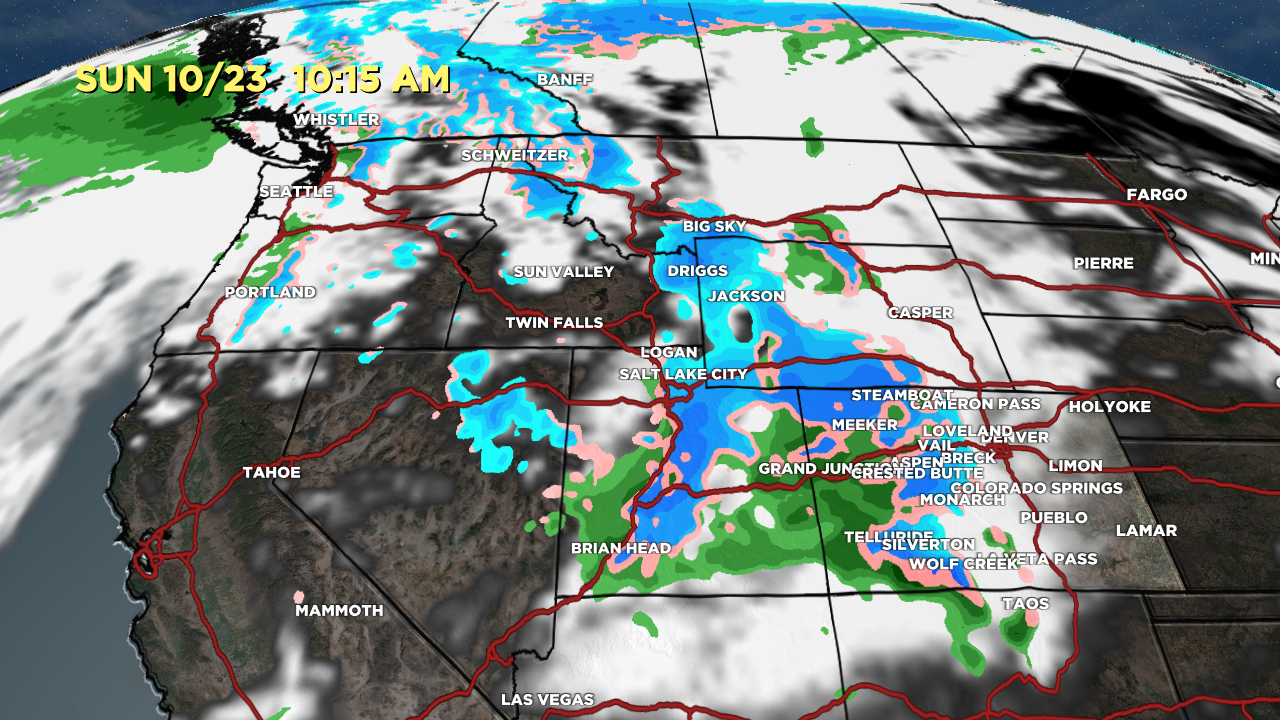
Forecast
Future radar and satellite valid 10/23 at 10:15am. Blue = snow, Green = rain, Pink = mix.

Ballpark snow totals 10/17-10/24:

My full video forecast:
As usually, PNW gets the lions share, but a nice start for CO. Been a very nice, prolonged fall with great color in the aspen.
Thanks, Tim!
Not fan of “if” part, but will welcome the natural snow and more importantly the much colder temps for corn-snow farming. Bring it!!
No doubt, CW!
My faith has been restored 😜❄️
Finally! 😉 Chris