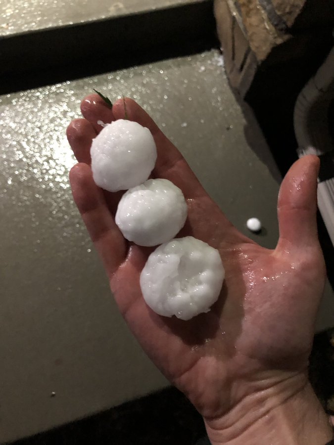
Tomer’s Take: Golfball sized hail fell over parts of Colorado’s Front Range last night (Erie, Timnath, Firestone, Brighton, Lochbuie, Wiggins) and is likely again this afternoon plus a couple tornadoes. This is the first ‘Enhanced Severe Weather Risk’ for Denver since 2018. Then, the pattern “cools” with heavy rain and mountain snow likely. The bulk of snow occurs above 10,000ft.
Longmont, CO last night (5/9), from Gabe Cox:

Forecast Freezing Level
Colorado’s Central Mountain Zone, Daily Max/Min:
5/10: 13500’/10800′
5/11: 11200’/10000′
5/12: 12100’/10200′
5/13: 10700’/10000′
5/14: 11500’/10300′
Forecast Pattern
Forecast jet stream valid 5/11. Notice the closed off area of low pressure over Eastern Colorado. This equates to a slow moving storm system with heavy precipitation.

Severe Weather
The Storm Prediction Center has issued an ‘Enhanced Risk’ (orange color) of severe thunderstorms with large hail and tornadoes for the Front Range and Eastern Plains of Colorado effect 5/10. This is the first ‘Enhance Risk’ since 2018 in Denver. ‘Slight Risk’ for severe thunderstorms in yellow.
Timing: 2pm-6pm in Denver, Boulder, Loveland, Fort Collins.

The Colorado Climate Center and State Climatologist Dr. Russ Schumacher put this climatological severe weather graphic together for Colorado. Notice where the bulk of colors are = Front Range and Eastern Plains.

Excessive Rainfall Outlook valid 5/11:

Forecast Timing
Forecast radar/satellite valid 5/10-5/15.
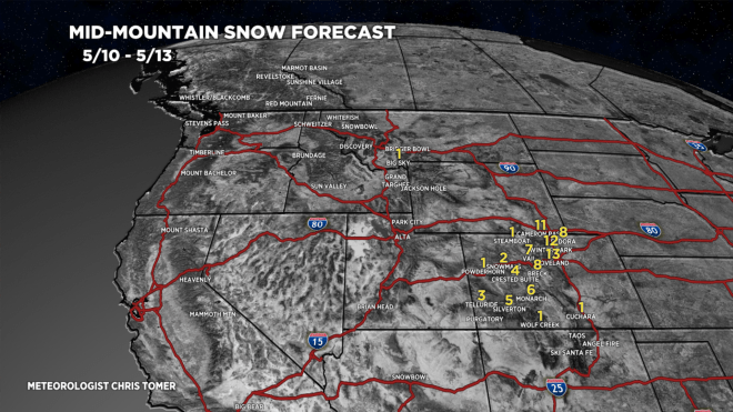
Forecast Totals
5/10-5/13: