Tomer’s Take: Two storm systems deliver colder air and a few snow bullseyes through 2/23. Plus, a little NW Flow possible adding to the grand totals.
Taos is reporting 10″ in the last 24 hours with a lot more yet to go.

Alta is reporting 5″ in the last 24 hours now officially breaking 500″ for the season so far!
Current Setup
Infrared satellite shows two primary storm systems lined-up.
- 1st low 2/14-2/15
- 2nd low 2/19-2/21

Forecast Pattern
Forecast jet stream valid 2/20. Good jet support and colder air for the 2/19-2/21 storm system. Plus some NW Flow adding to the totals.

Forecast Timing
Forecast radar/satellite valid 2/14-2/19.
Forecast Totals
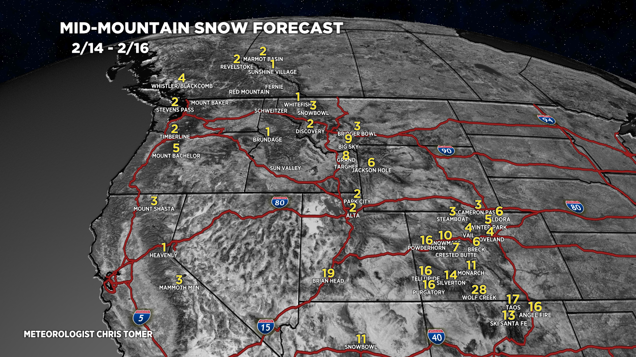
2/14-2/16:

2/17-2/23:

2/14-2/23.
Southern CO grand totals:

2/14-2/23.
Central + Northern CO Grand Totals. A little NW Flow clearly having an effect.

2/14-2/23:


Chris,
Please include Crested Butte in your CO breakdown. Thanks.
Thanks, Josh…you’ll find a CB breakdown in today’s update. Chris
Love your style and all the great info you share. Thank you thank you thank you.
Do you mean for the headline tk say Bulleyes?
Thanks, Kevin! Bullseyes as in pockets of really heavy snowfall accumulation.
Chris