Tomer’s Take:
- Pattern change remains on-track 10/22-10/24.
- A second low pressure system possible 10/26-10/28.
- Beneficiaries: PNW, BC, Banff, MT, ID, CO, WY, UT.
- Strong wind gusts likely 40-95mph 10/22-10/25.
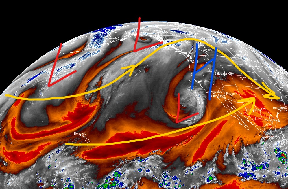
Current Setup
Water vapor satellite shows the big Western high pressure ridge and cut-off low pressure. This is called a Rex Block. What can change this? The parade of low pressure systems in the North Pacific running into Alaska/BC will help to dislodge this pattern setting the stage for Intermountain snow 10/22-10/24.

Pattern Change
The big high gets pushed west and is replaced by a big trough of low pressure 10/22-10/24. Below is the forecast mid-mountain atmospheric pressure anomalies valid 10/23.

Forecast Wind Gusts
| Longs Peak | MPH |
| 10/22 | 65 |
| 10/23 | 65 |
| 10/24 | 60 |
| 10/25 | 75 |
| Crestone Peak | MPH |
| 10/22 | 65 |
| 10/23 | 95 |
| 10/24 | 45 |
| 10/25 | 45 |
| Kings Peak | MPH |
| 10/22 | 60 |
| 10/23 | 40 |
| 10/24 | 35 |
| 10/25 | 45 |
| Grand Teton | MPH |
| 10/21 | 55 |
| 10/22 | 50 |
| 10/23 | 30 |
| 10/24 | 40 |
| 10/25 | 45 |
Forecast
Forecast radar/satellite valid 10pm Saturday 10/22:

Forecast 9am Sunday 10/23:

Forecast 6pm Sunday 10/23:

Forecast snow totals by late 10/24:

My forecast video for 10/19:
Chris, thanks for the information! As usual you work in real time according to viewer needs. You are the primary reason I watch ch2 on cable!9
Thanks, Roy!