Tomer’s Take:
- Storm #1 continues across the Intermountain West on 10/23-10/24.
- Strong wind gusts likely 40-105mph.
- Storm #2 arrives 10/26-10/28.
- Storm #2 is weaker than storm #1.
Alta, UT and Snowbird, UT are reporting 12-19″ of new snow in the last 24 hours. And, it’s not done yet.

Current Setup
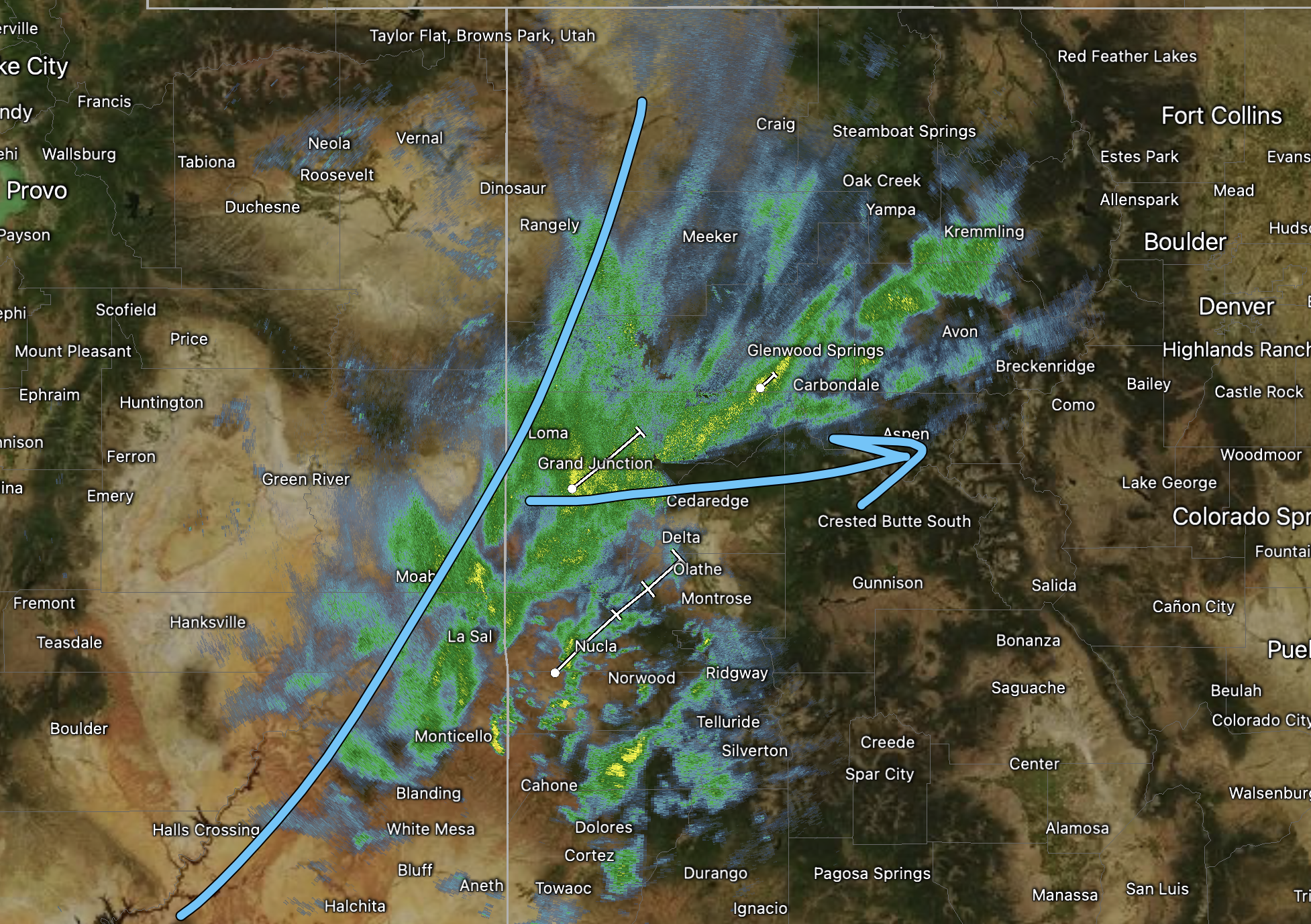
Radar shows the rain/snow moving into Colorado from Utah at 7am 10/23/2022. Snow levels start around 9000ft then gradually drop to 6500ft. Notice the yellow returns on the scan. Some lightning is possible early in the evolution.

Forecast Wind Gusts
Strong wind gusts are likely above treeline in Colorado on 10/23/2022.

Forecast Timing
Forecast radar/satellite valid 6pm Sunday 10/23/2022.

Forecast radar/satellite valid 6am Monday 10/24/2022.

Storm #2
Forecast radar/satellite valid 6pm Wednesday 10/26/2022.

Forecast Snowfall
Forecast total snowfall (inches) 10/23-10/24.

Forecast total snowfall (inches) 10/26-10/28.

My forecast video:

I have been following Chris’s YouTube channel since last winter and it has become my go to site for snow forecasts. I love the details and his great way of explaining everything in layman language. I know he is based out of Colorado but appreciate the fact he includes 3 time Ski Magazine #1 Resort in the West Sun Valley Idaho and other resorts all over the West. Great job.
Thanks, Trout! Chris
Chris is the most accurate and easy to understand meteorologist ever. I love the way he describes the weather “down to the cellular level” and yet makes it so understandable. Thanks Chris, I tell everyone to watch you on channel 2 or your blog [and my son is a photojournalist for channel 7, ABC so I should be watching them for weather but no way]
Thanks, Ann! Chris