Tomer’s Take: The next surge of wildfire smoke from Canada is moving south. A reinforcing shot hits MT, northern UT, WY, northern CO, and the Great Plains on 5/21-5/22. And, the afternoon thunderstorm pattern is fully engaged across the Intermountain West through the end of May.
Is this normal for May? In Colorado, the answer is ‘no’. I can’t remember the last time we had an air quality advisory in the month of May. Fortunately, May is Denver’s wettest month on average. Rain helps cleanse the air.
Smoke Forecast
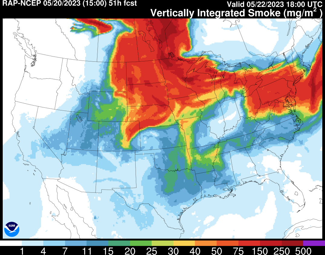
About 100-150 wildfires are burning in Canada (British Columbia and northern Alberta) and will push another surge of smoke into MT, WY, northern UT, and northern CO on 5/21-5/23.
RAP smoke (vertically integrated smoke) model forecast animation valid 5/20-5/22. Air quality and visibility look severe across parts of MT, ND, SD, WY, and NE.
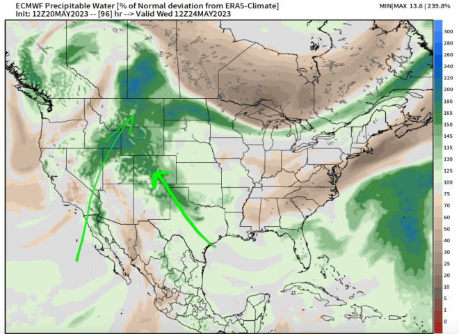
Afternoon Thunderstorm Pattern
Extra atmospheric moisture keeps the afternoon t-storm pattern going across the Intermountain West through 5/24 and likely through the end of May.
Below is forecast atmospheric precipitable water percent of normal deviation. The green and blue shades represent above normal moisture. This helps fuel afternoon thunderstorms.
Valid 5/24: