Tomer’s Take:
- Overall intensity of this surge is trending a notch weaker in Colorado. Call it a low to medium intensity surge.
- The location of most precipitation accumulation is also changing. Overall it’s shifting East/Southeast. It favors the Southern Mountains, Continental Divide and East. Lower precip chances across the Western Slope.
- Saturday and Sunday mornings start mostly dry.
- Watch for weather by 11am on Sunday and Monday in a few locations including the Sangres and Front Range high peaks.
Current Setup
The key area of high pressure is starting to move east and that opens the door to the next Monsoon surge.

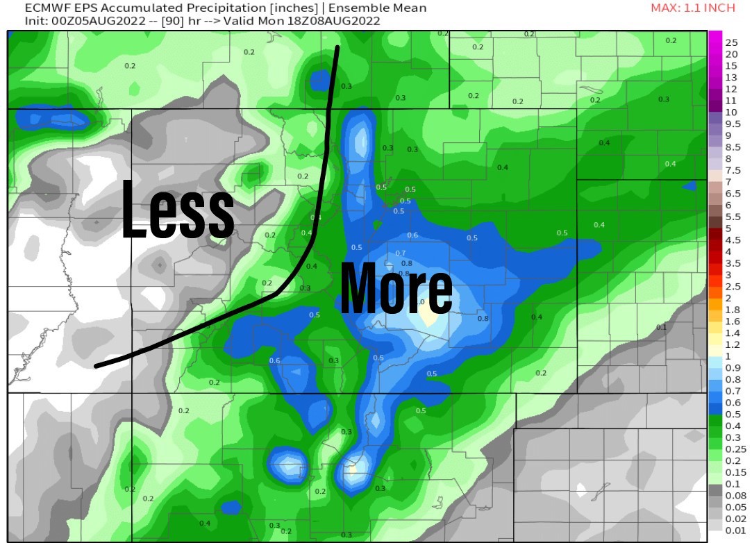
Precip Placement
The bulk of precip through the weekend falls in the Southern Mountains, Continental Divide and East. Less across the Western Slope.
The wettest mountain ranges through the weekend are the Sangres and Wet Mountains.

Forecast
| Crestone Peak | AM | PM |
| 8/5 | Dry | 60% |
| 8/6 | Dry | 90% |
| 8/7 | 20% | 90% |
| 8/8 | 30% | 90% |
| Longs Peak | AM | PM |
| 8/5 | Dry | 80% |
| 8/6 | Dry | 40% |
| 8/7 | 20% | 90% |
| 8/8 | 20% | 60% |
| Quandary Peak | AM | PM |
| 8/5 | Dry | 80% |
| 8/6 | Dry | 50% |
| 8/7 | 10% | 90% |
| 8/8 | Dry | 30% |