Tomer’s Take:
- Two surges are lined-up.
- Peak surge in Colorado occurs 8/14-8/17. This is a medium intensity surge.
- A second smaller surge occurs 8/20-8/21. This coincides with the LT100 trail run in Leadville on 8/20.
- Monsoon surges make rain/t-storms more likely. Sometimes the precipitation can start before Noon and last late into the night.
Current Setup
Water vapor satellite shows the southerly wind flow escorting this Monsoon surge north through AZ, UT, WY, and into CO. Red/orange colors = drier air aloft.

Forecast
| Massive-Elbert Zone | AM | PM |
| 8/15 | 10% | 100% |
| 8/16 | 30% | 100% |
| 8/17 | 10% | 70% |
| 8/18 | Dry | 50% |
| 8/19 | Dry | 50% |
| 8/20 | Dry | 90% |
| 8/21 | 10% | 80% |
Specific forecast for 8/20 LT100 run:
| Elbert-Massive Zone | 5am | 10am | Noon | 5pm | 9pm |
| Precip Chance 8/20 | 0% | 20% | 90% | 90% | 40% |
Bonus: Longs Peak
| Longs Peak | AM | PM |
| 8/15 | 20% | 100% |
| 8/16 | 30% | 60% |
| 8/17 | Dry | 60% |
| 8/18 | Dry | 60% |
| 8/19 | Dry | 70% |
| 8/20 | Dry | 90% |
| 8/21 | 10% | 90% |
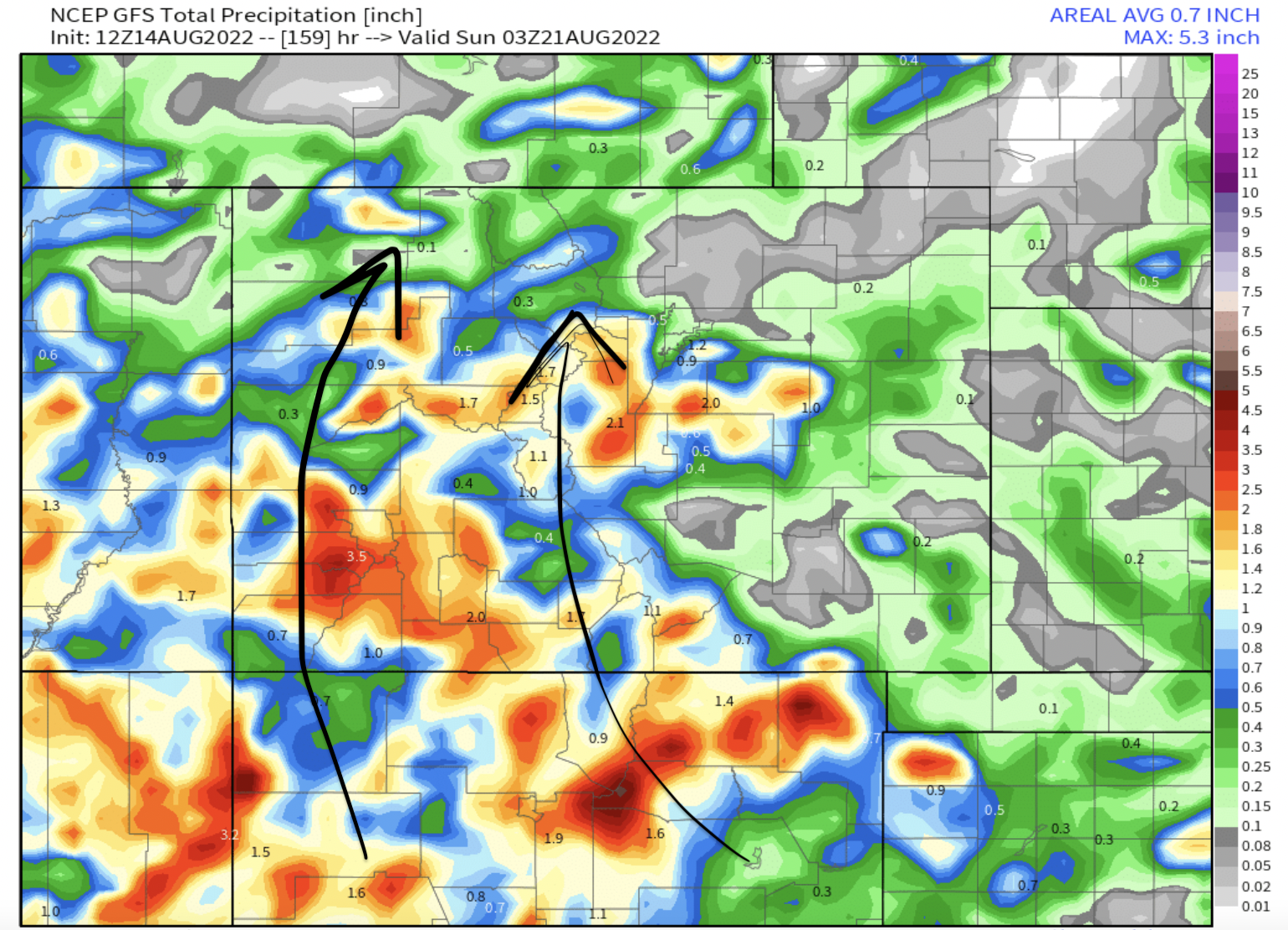
Total Precipitation
This is total rainfall by the night of 8/20. 1-3+ inches possible in the mountains south of I-70. The San Juan Mountains could see flash flooding.

Here’s my 8/14 mountain weather forecast video:
I am planning on a backpack in the Never Summers, Looks like it will be wet.
Thanks, Judi!