Tomer’s Take:
- Hot and drier across Colorado through 8/13 with normal afternoon thunderstorm chances.
- Moisture starts to increase afternoon 8/14.
- This equates to a large window for FKT’s, high altitude loops, and big outings.
- Bulk of next Monsoon surge in Colorado occurs 8/16-8/18.
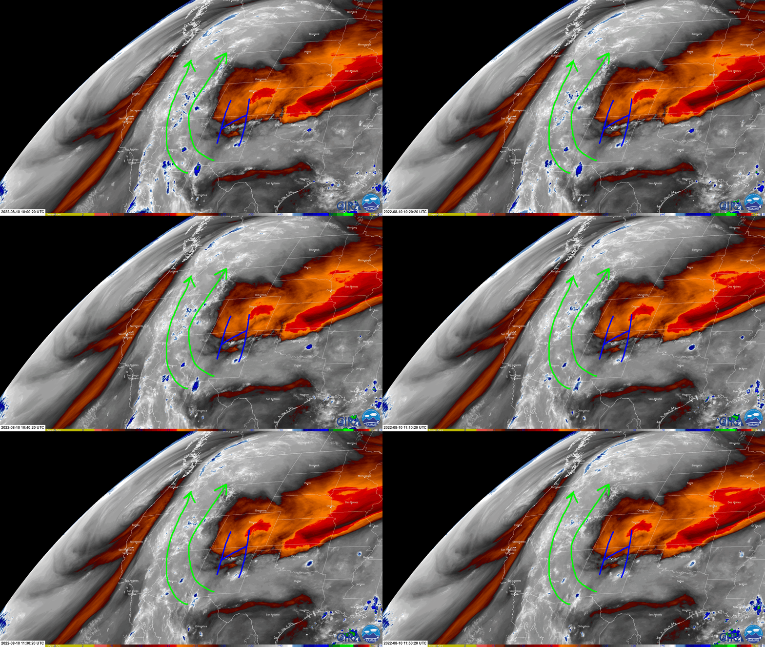
- Colorado is currently isolated and protected by the position of the key high pressure. Monsoon moisture is being sent into UT and all the way north into ID and parts of the PNW.
Water vapor satellite shows the high protecting Colorado. Notice how far north the current Monsoon surge is traveling. Orange/red = drier air aloft.

Timing
In Colorado, here’s my precipitation forecast for the Central Mountain Zone:
| Central Mountains | AM | PM |
| 8/11 | DRY | 10% |
| 8/12 | DRY | 20% |
| 8/13 | DRY | 20% |
| 8/14 | DRY | 50% |
| 8/15 | DRY | 70% |
| 8/16 SURGE | DRY | 90% |
| 8/17 SURGE | DRY | 90% |
| 8/18 SURGE | DRY | 80% |
Next Surge
Atmospheric moisture increases to 200% of normal over parts of Colorado 8/16-8/18.


I’ll take all of the moisture. Cool things off.
Thanks, Josephine!
Took advantage of the sunny skies up in the Tenmile Range. Thanks Chris
Very nice, John! Thanks, Chris