Tomer’s Take:
- The door remains wide open for an active Monsoon through 8/10.
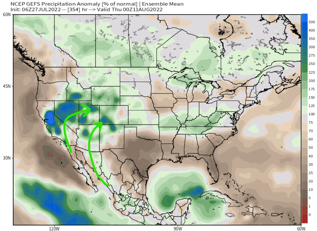
- Atmospheric moisture values run 150-300% of normal through 8/10 over parts of Colorado – especially the Mountains south of I-70. Drier north of I-70.
- It’s important to time-out the surges. Life is more normal in-between surges.
- Two surges in my CO forecast: 1) 7/28-7/30, 2) 8/3-8/4.
Big Events
Let’s get requests done first. I’ve had numerous forecasts requests. This info might be helpful to everyone.
San Juan Solstice Ultra, 7/30: Dry in the morning, high chance for midday/afternoon t-storms. Course will be wet from Thursday-Friday moisture surge.
Never Summer Ultra, 7/29-7/31: Dry all mornings, periods of sun, medium risk for afternoon t-storms. Monsoon has less effect on the Northern Mountains.
Chicago Basin 14ers, 7/28-7/30: No-go 7/28-7/29, drier morning 7/30 with midday/afternoon rain/t-storms likely.
Long Term Monsoon
Data suggest abnormally high amounts of precipitation through 8/10. This means the seasonal Monsoon remains robust.
From a forecasting perspective, this means afternoon rain/t-storms are likely throughout this period.

Here’s the NWS digital point forecast for 13,000ft around Twin Lakes/Leadville valid 7/28-7/29. Notice dewpoints in the 30s. That’s high for mountain environments in Colorado.

I’m planning my annual loop in the Never Summers in August. I am usually out for 3-4 days. Can you recommend good dates to avoid the worst of the storms? thank you! Love your forecasting!
judi