Tomer’s Take:
- Peak surge underway.
- The first surge of Monsoon moisture combined with upper level jet support generated a major hailstorm in downtown Estes Park.
- Golfball sized hail (or larger) fell just outside Fort Collins in Wellington, Severance, and around Timnath.
- 1-3 inches of rainfall with a few different lines of thunderstorms accumulated around Fort Collins and across Northern Colorado.
- Another surge of moisture Thursday afternoon/night delivers similar weather along with high chances for flash flooding.
Big Event Forecast Update
Never Summer Ultra, 7/29-7/31: Dry all mornings, periods of sun, 40-70% chances for afternoon t-storms (highest % SAT-SUN afternoons). Monsoon has less effect on the Northern Mountains.
Chicago Basin 14ers, 7/28-7/30: No-go 7/28-7/29, drier mornings 7/30 & 7/31 with 80% chances for midday/afternoon rain/t-storms.
Pikes Peak Ultra, 7/30: Dry morning, 80% t-storms by Noon through afternoon.
Estes Park Hailstorm
This occurred 10pm 7/27/2022 in downtown Estes Park, CO. Video courtesy Kirby Hazelton.
One additional photo courtesy the Estes Park Police Department.

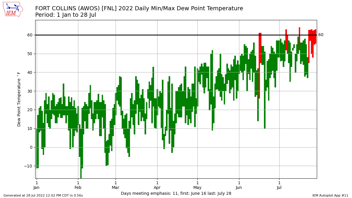
Dewpoint
Dewpoints are pegged at 60°F in Fort Collins = a clear signal of a Monsoon surge. This represents available moisture to fuel thunderstorms and flash flooding.

Robust Monsoon through 8/10
Medium/long-range data suggest above normal precipitation through at least 8/10. This strongly suggests a robust Monsoon.
