Tomer’s Take: Rain/Snow appear likely for parts of Colorado between the afternoon of 9/10 and 9/15. The 14ers could see snow accumulation. Why? The Subtropical Jet is back plus it will entrain some of CAT-5 Jova’s moisture. Remember it from May, June and early July? This is a foreshadowing of what to expect this Winter. My take, this will be a big Winter in parts of Colorado. I’ll release my complete Winter Forecast soon.
CAT-5 Hurricane Jova
The Subtropical Jet will absorb and then transfer some of Hurricane Jova’s moisture into Colorado between the afternoon of 9/10-9/15. This will encourage additional rain/thunderstorms/snow.

Subtropical Jet
Remember the Subtropical Jet when it was a major player during May, June and early July 2023? It nailed parts of the West with heavy precipitation. This is an efficient transport pattern.
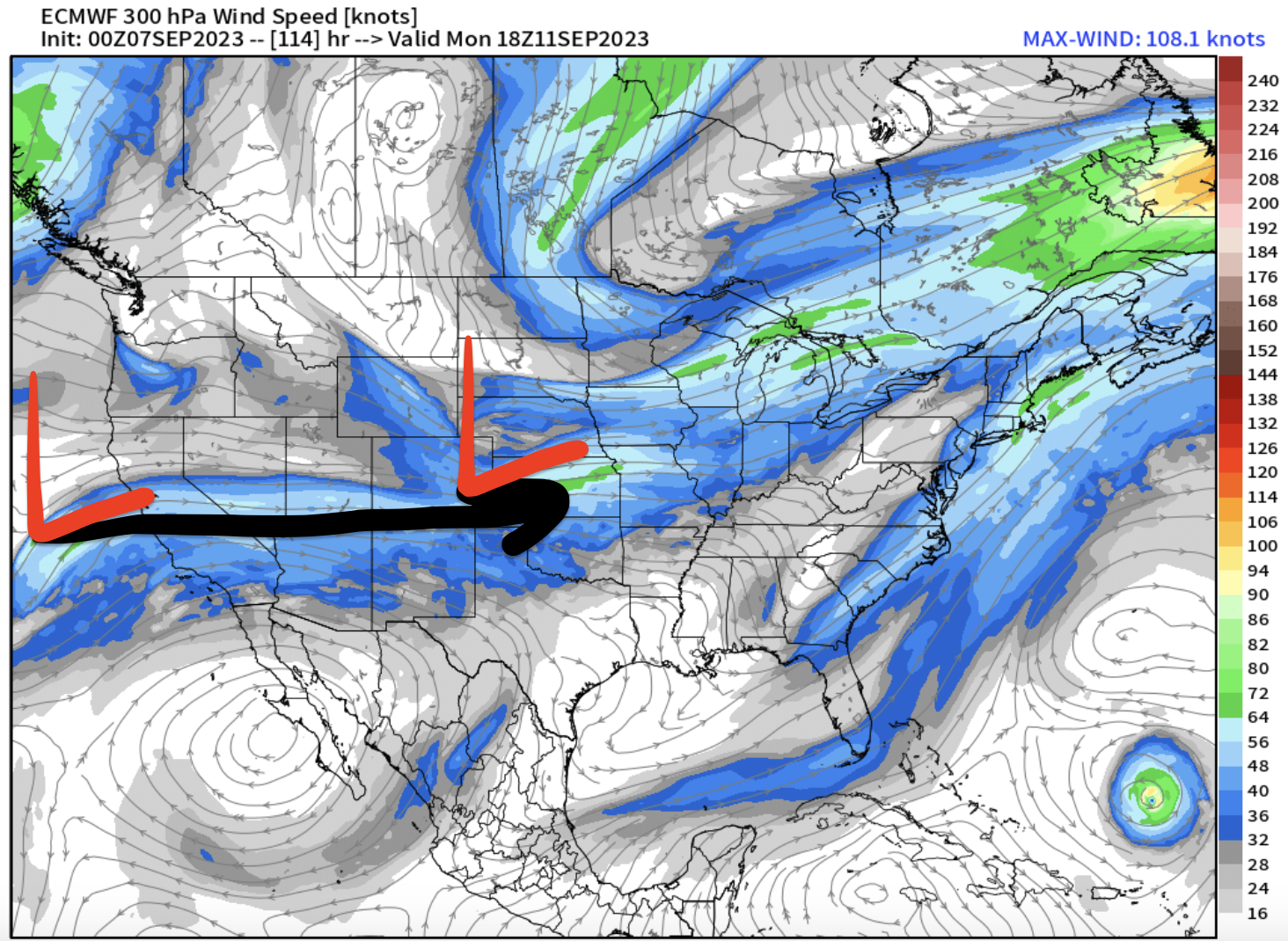
Below is forecast jet stream level valid 9/11. Notice the Subtropical Jet is back.

Below is forecast precipitable water percent of normal valid afternoon of 9/10. Some of Jova’s moisture shield becomes entrained and transported.

Below is forecast precipitation valid 9/11. This represents above normal precipitation by September standards in Colorado.

Specifics – Mountain Forecast
Longs Peak, Summit Level
9/10: 90% PM Rain to Snow with accumulation, 26/33F.
9/11: 90% Snow with accumulation, 23/30F.
9/12: PM 40% Snow, 23/34F.
9/13: PM 30% Snow, 26/35F.
9/14: PM 60% Snow, 28/32F.
9/15: PM 60% Snow, 19/30F.
Chicago Basin, Summit Level
9/10: PM 30% Rain/Snow, 35/49F.
9/11: 40% Rain/Snow, 32/42F.
9/12: 80% Rain/Snow, 29/39F.
9/13: 90% Snow with accumulation, 27/32F.
9/14: 80% Snow, 25/37F.
9/15: PM 40% rain/snow, 21/40F.

I’m glad I got in a summit of Long’s last week! Sunny, pleasant, and no wind on the top 8/30. It looks like it will be a very different experience up there starting next week!
No doubt, Nathan! Longs is covered in snow this morning.