Tomer’s Take: In my last update, I highlighted an active weather pattern for Labor Day Weekend and early September across the Intermountain West. The moisture will come in two waves, and you might even say curveballs. The first includes the remnants of a tropical system plus Monsoonal moisture 8/25-8/27, and a Monsoonal surge 8/31-9/2. Beyond this, an active jet stream and Monsoonal remnants produce above normal moisture through 9/15.
Tropical Remnants
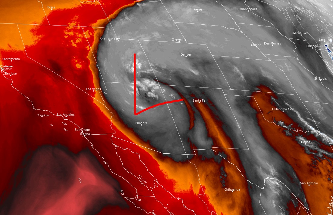
Water vapor satellite clearly shows an area of low pressure tracking north from the 4-Corners. This is loaded with tropical moisture. Red/orange = drier air aloft. White/Blue = water vapor aloft.

8/25-8/27
Below is forecast total precipitation percent of normal through 8/27. The green/blue areas represent above normal precipitation. Some areas in UT, CO, WY, AZ, NM run 100-500% of normal.
And, some of this moisture will fall as rain/snow on the higher peaks especially in WY.

A few examples.
Granite Peak, MT:
8/25: AM dry, PM 50% rain/t-storms.
8/26: AM dry, PM 80% rain/t-storms/snow.
8/27: AM 30%, PM 90% rain/snow.
Gannett Peak, WY:
8/25: AM dry, PM 50% rain/t-storms.
8/26: AM dry, PM 40% rain/t-storms/snow.
8/27: AM 30%, PM 90% rain/snow.
Labor Day Weekend
Below is forecast precipitation over Labor Day Weekend. The green represents actual precipitation. You’re looking at a Monsoonal surge across AZ, NM, UT, CO.

September 1-15
Below is forecast precipitation percentage of normal. An active jet stream generates above normal precipitation across parts of the West in green including WY, UT, NV, CO, ID.

Bottom Line
The atmosphere is throwing a few curveballs.
- Tropical remnants
- Late Monsoon (into September)
- Active late Summer Jet (into September)

Chris- Thank you for your mountain analysis as always! I have the Wind river high route planned just beyond Labor day. How is it looking?
Hi Jon, the pattern in WY dries out after Labor Day (but, it’s active 9/1-9/5). I’ll do an updated post soon.