I started this Saturday off with a fantastic workout in the Foothills of Colorado. This time I was greeted my much colder temps and an inch of snow on parts of the trail. I also bumped into my friend Justin Becker and we finished the trail run together. Great seeing and chatting with him!

Atmospheric River
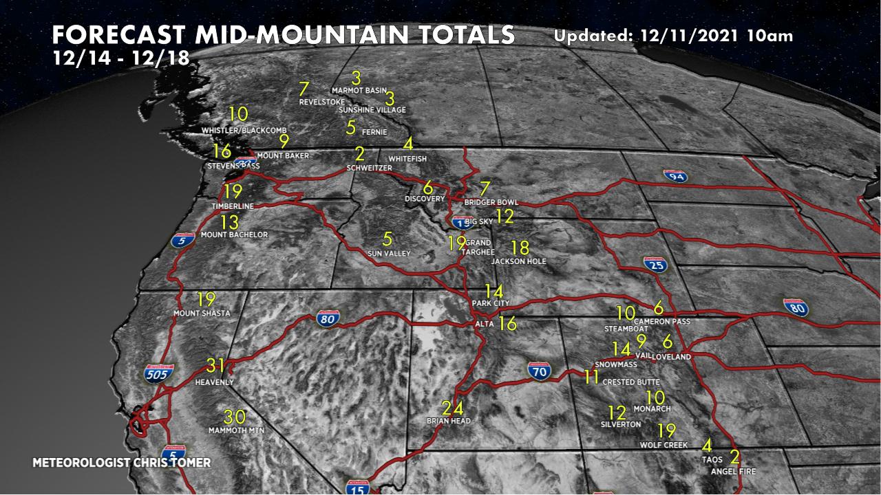
Tomer’s Take
- A weak to moderate intensity atmospheric river (AR) continues to deliver heavy snow (25-40 inches) to the high volcanoes and high Cascades of the Pacific Northwest today and tapers-off on Sunday.
- This AR then slides south and nails California’s High Sierra.
- The key elevation looks to be 5000′. Stay above that for several feet of snow accumulation 12/12-12/14.
- This storm system then breaks loose and delivers 1-2 feet of snow accumulation to parts of Utah and Colorado 12/14-12/15.
- In Colorado, I like the Western Slope ski areas (again) for the most snow accumulation 12/14-12/15.
- Idaho, SW Montana, and Wyoming all get snow as well.
Here’s my forecast video with more analysis and two-timeframe snow forecast the West.
Any of this River going to wash up on the shores of northern NM?
Hi Rob – unfortunately not much…the tide with this AR doesn’t quite reach Taos or Angel Fire. Chris
Keep it coming Chris ! You were spot on with the 24″ triangle!!! I was at 11,000 feet on Friday cloud 9 on Aspen Highlands. I’ve lived here my whole life and it’s been a long time since I’ve seen snow like that! We need it. Thanks Chris your awesome
This is fantastic! What a feeling to hit that much powder. Thanks, Nathan. Next storm system en route!
Chris