Tomer’s Take:
- In Colorado, two drier days ahead 8/17-8/18 for the Central and Northern Mountains (& Front Range). Most afternoon t-storms 8/17 stay in Southern Colorado.
- The next Monsoon surge is smaller but lingers: 8/20-8/23. Afternoon rain/t-storms are more likely on these days.
- LT 100 run and Triple Bypass bike are 8/20.
Current Setup
Water vapor satellite shows drier air filtering into the Northern Colorado as this current surge comes to an end. The bulk of remaining moisture stays in Southern Colorado on 8/17. Orange/red colors = drier air aloft.

Flash Flood Potential
This is the excessive rainfall outlook valid 8/17. There is at least a 15% chance of flash flooding in the yellow shaded areas.

This is the excessive rainfall outlook valid Friday 8/19 (8/18 is dry). Notice the Monsoon plume moving back into Colorado from the West. There is at least a 15% chance of flash flooding in the yellow shaded areas.

Forecast
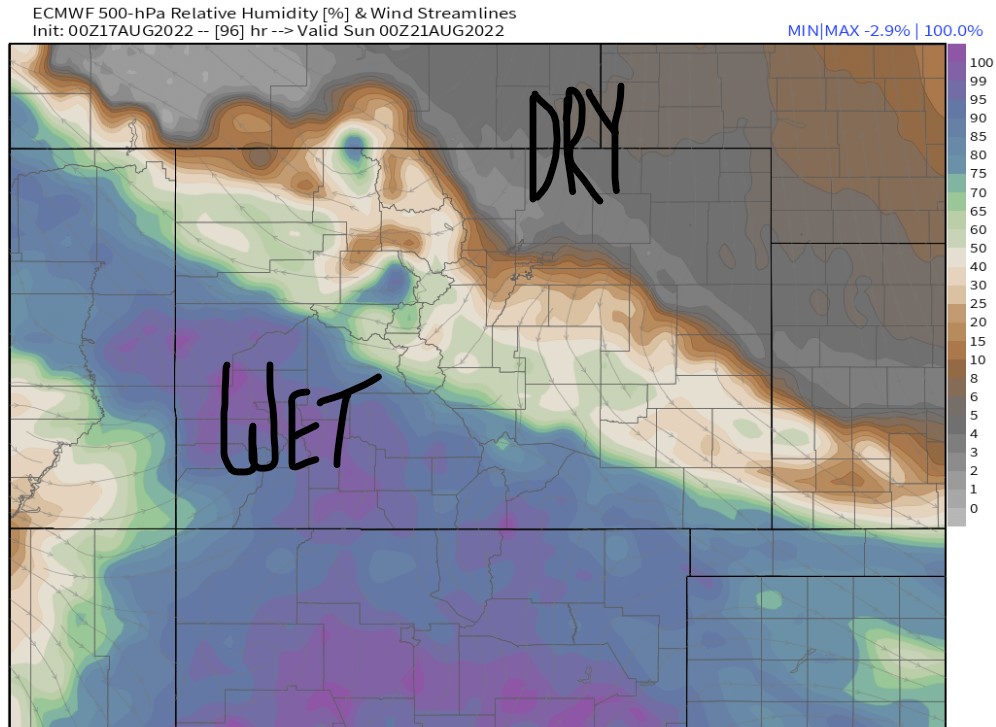
Forecast humidity in the middle of the atmosphere valid afternoon 8/20. There is a sharp dividing line between drier air (from the North) and moist air (from the Southwest) with the next Monsoon surge. Leadville is caught in-between. The Triple Bypass is caught in-between but slightly on the drier side.

| Massive-Elbert Zone | AM | PM |
| 8/17 | Dry | 50% |
| 8/18 | Dry | 10% |
| 8/19 | Dry | 70% |
| 8/20 | Dry | 60% |
| 8/21 | 10% | 70% |
| 8/22 | 10% | 60% |
Hourly forecast for Leadville on 8/20:
| Hour | 4am | 10am | Noon | 4pm | 9pm |
| % | Dry | Dry | 60% | 60% | 30% |
Triple Bypass 8/20:
Air temps on Loveland Pass and Vail Pass (high/low): 55°/30°F.
| Hour | 4am | 10am | Noon | 4pm | 9pm |
| % | Dry | Dry | 50% | 50% | 20% |
Total Precip
Forecast total precipitation between 8/17-8/20. Notice the bulk of accumulation is I-70 and South.
