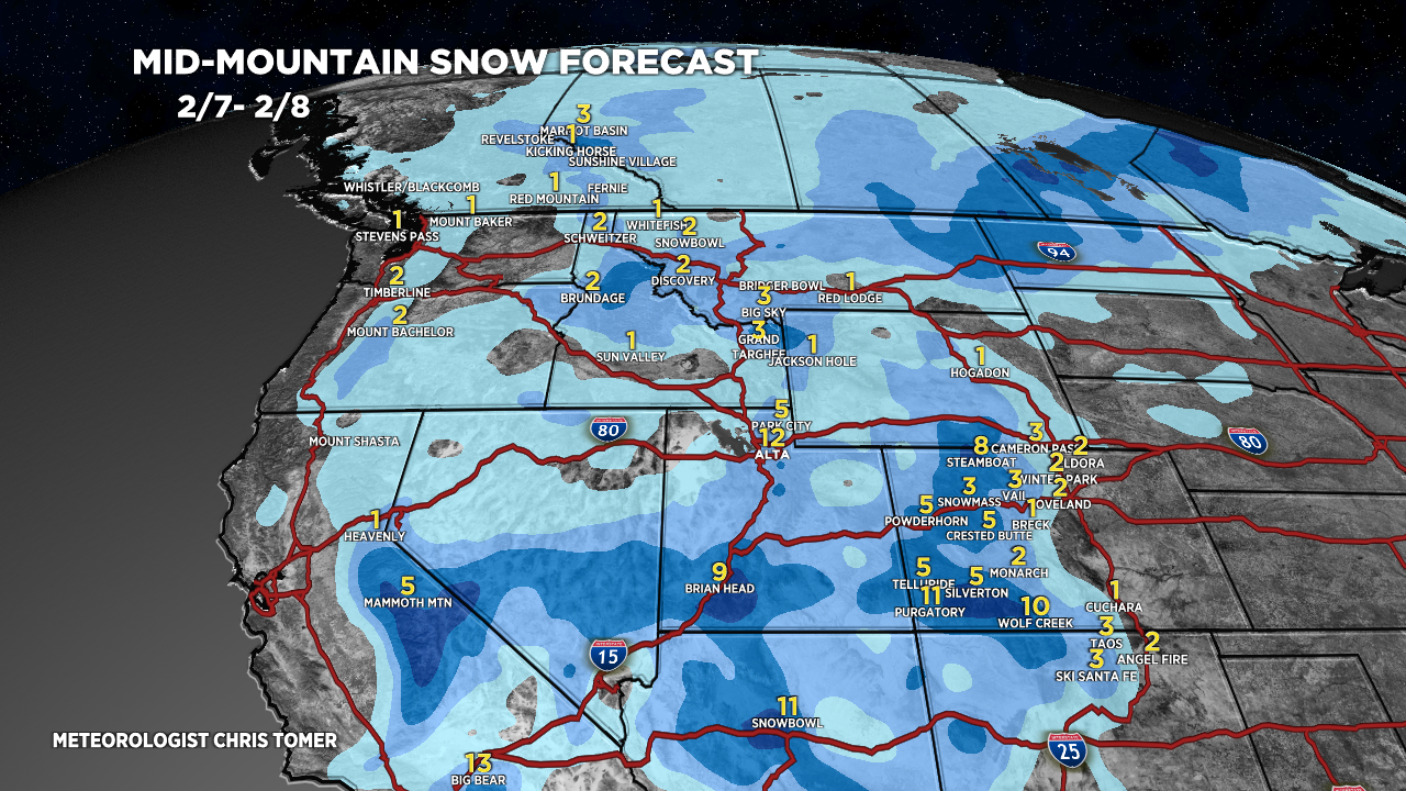
Tomer’s Take: A large storm system continues to move slowly through the Intermountain West. Two additional pieces of energy rotate into the mix and keeps the snow going through 2/10. Then the pattern shifts north 2/11-2/14 with snow targeting the PNW/BC/Northern Tier. A warmer, drier pattern builds 2/15-2/18.
20″ in 24 hours at Alta, UT and it continues to snow hard. I expect another foot of accumulation tonight through 2/8.
Snow Timeline:
Wasatch: Now-2/9
Tetons: Now-2/9, 2/14-2/15.
Colorado: Now-2/10
Revelstoke: 2/11-2/13, 2/15.
My afternoon forecast video update:
Current Setup
Water vapor satellite shows the current stormtrack. The primary area of low pressure remains over the Intermountain West. Smaller pieces of energy will rotate in from the west and keeps the snow going through 2/10.
Orange/red = drier air aloft.

El Nino Update
Latest forecast guidance suggests El Nino transitions to a Neutral Phase by May 2024 and eventually La Nina by July-August 2024. This suggests that next Winter (2024-2025) will be a La Nina Winter.

Forecast Jet Stream
Forecast Radar & Satellite
Forecast Totals


VT/NH/ME Snow: 2/12-2/13.

