Tomer’s Take: It’s a busy weekend ahead for athletes with both the Pikes Peak Ascent/Marathon and Run Rabbit Run 50/100M. Both events will have weather impacts early in the weekend, drier later. I’m forecasting new snow accumulation above treeline on 9/14 and 9/15 with a cold front and active Subtropical Jet Stream.
Pikes Peak Summit
Snow accumulated on 9/10-9/11. I’m forecasting an additional 3-6 inches between 9/14-9/15.
LIVE summit cam 9/13:

Setup
Below is the forecast jet stream valid 9/14-9/15. Notice the active Subtropical jet and cold front merger.

Snow
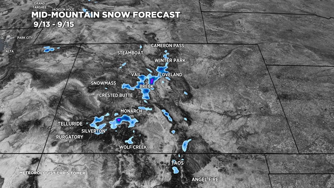
Below is forecast snow accumulation between 9/13-9/15. The lightest blue shade is 1-3 inches with escalating values by color. Some mountain locations above treeline (above 13K in particular) could see 6″ or more.

Mountain & Event Forecast
Pikes Peak, Summit Level.
9/14: PM 1-2 inches snow,10-25mph gusts, 25/37F.
9/15: 2-4 inches snow, 10-25mph gusts, 25/28F.
9/16: AM dry, sun, PM flurries, 10-20mph gusts, 20/39F.
9/17: AM dry, sun, PM 40% rain/snow, 15-25mph gusts, 25/43F.
Run Rabbit Run, 10K Level.
9/14: 100% rain after 8am, 44F to 36F.
9/15: Overcast and valley fog, AM 20% rain/snow, PM 40% rain/snow, 35/43F.
9/16: Dry, sun, 37/52F.
Longs Peak, Summit Level.
9/14: PM 3-6 inches snow, 31F to 21F.
9/15: AM 1-3 inches snow, 20/24F.
9/16: Dry, sun, 21/35F.
Nolan’s Course, Summit Level.
9/14: PM 2-4 inches snow, 20/37F.
9/15: 1-4 inches snow, 23/31F.
9/16: Dry, sun, 19/42F.