Tomer’s Take:
- Next storm system and pre-storm snow through 10/27.
- Beneficiaries: PNW, BC, Banff, MT, ID, WY, UT, CO, NM.
- High pressure rebuilds 10/28-10/30.
- Possible trough and active pattern 10/31-11/3 and possible NW flow.
Current Setup
Water vapor satellite shows the active storm track and low pressure systems lined-up. Orange/red = drier air aloft.

10/31-11/3
Let’s look down the road. Some data suggest another trough with buckling jet stream across the Intermountain West 10/31-11/3. Below, notice the forecast mid-atmosphere pressure anomalies valid 11/3/2022.

Let’s have some fun and check the new experimental GFS v16.3 for exact same date/time. Forecast surface pressure/wind/precip/thickness valid 11/3/2022:

What’s the bottom line? Early November could be active/snowy/colder across the Intermountain West and PNW.
Forecast Timing
Forecast radar/satellite 10/25-10/27.
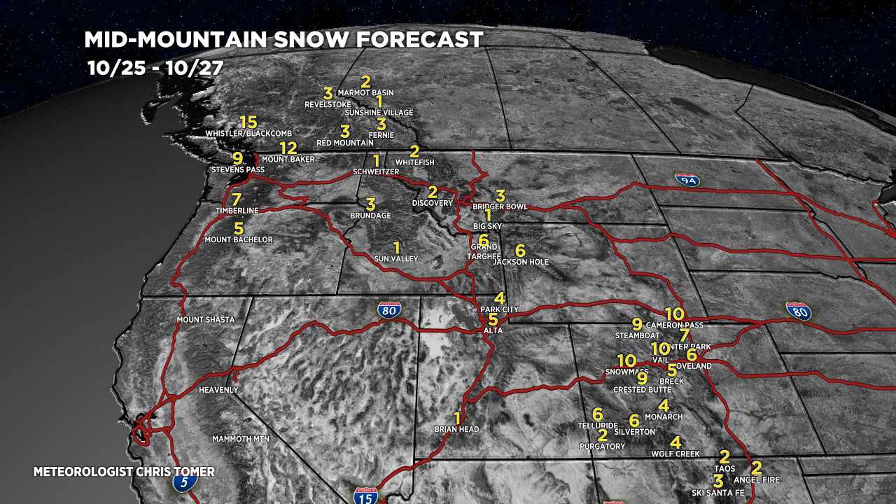
Forecast Snowfall
Forecast snowfall totals (inches) 10/25-10/27.

Forecast snowfall totals (inches) 10/31-11/3.

New Ski Atlas
There’s a new backcountry ski atlas that caught my attention. It features Cameron Pass, Colorado and is written by friend Rodney Ley who has skied the area for 50 years. I’ll take a look at it soon in one of these updates.
Discussing: when does a hard freeze happen is perms frost a hard freeze. We live dn tn Castle Rock.
Thank you.
Hi Bonnie – Castle Rock could dip into teens/low 20s on Friday morning (10/28) and Saturday morning (10/29). Chris