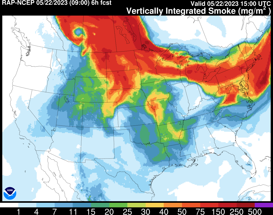
Tomer’s Take: Thick smoke continues to choke MT, WY, ID, parts of UT, parts of CO, and the Great Plains through 5/23. Then, the smoke starts to move east and away late 5/23 into 5/24 with improving air quality. Also, the afternoon thunderstorm pattern is engaged through the end of May.
Smoke Forecast
Below is forecast vertically integrated smoke from the RAP model valid 5/22-5/24.
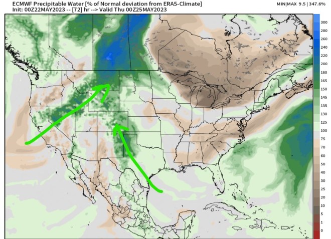
Moisture Feed
Forecast precipitable water percentage of normal is running 100-200% at times. This helps fuel afternoon thunderstorms across the Intermountain West. I expect this to continue through the end of May.
Forecast Timing
Forecast radar/satellite valid 5/22-5/27:
Snowmelt
The Western snowpack is melting rapidly, but there’s still plenty of snowpack remaining in places.
Take look at Steamboat, CO – photo by Shannon Lukens:

Current snow-water-equivalent percent of median in Colorado:

Utah:

I noticed lots of brown snow while biking up Trail Ridge Road yesterday. This makes the snow pack melt faster, right? I wondered if they had higher than normal snowpack there. Looked about the same to me. thank you.
Hi Judi – yes that’s correct, the dust layer accelerates the snowmelt. Thanks! Chris