Tomer’s Take:
- A powerful jet stream returns to the West through 5/15. It resembles April.
- The future storm track keeps the bulk of precipitation north of Colorado through 5/15. This leaves Colorado and much of the Intermountain West in a windy pattern.
- Blowing dust is again possible.
- The best chances for snow stays in northern UT, WY, ID, MT, and PNW.
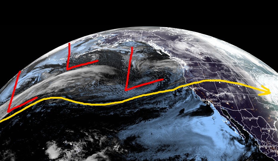
Infrared satellite shows the storm track and storm systems lined-up. They’re riding a powerful jet stream.

Wind Gust Forecast
| Forecast (MPH) | 5/7 | 5/8 | 5/9 | 5/10 |
| Crestone Needle | 70 | 75 | 70 | 60 |
| Quandary Peak | 50 | 60 | 55 | 35 |
| Mount Sneffels | 60 | 70 | 70 | 50 |
| Humphreys Peak | 65 | 70 | 60 | 50 |
| Wheeler Peak | 50 | 60 | 60 | 45 |
| Kings Peak | 45 | 60 | 55 | 55 |
Jet Stream
A powerful jet stream returns to the West resembling April. It’s following La Nina architecture. The yellow/orange/red colors represent the strongest winds.

Snow Forecast
5/6-5/15:

Everest Weather
Enjoyed a conversation yesterday with Alan Arnette, Michael Fagin, and Marc DeKeyser. The focus is on Everest Weather. Michael and Marc are fellow cohorts who provide weather forecasts and guidance to teams climbing Everest (and other peaks).
You can watch our discussion by clicking here.
Thanks for all you do for the mountain community Chris! Your expert analysis is well appreciated! And thanks for including Humphreys in your analysis as we try to decide on the best summit weather ahead for our Arizona adventure this coming week!
You bet, thanks, Jon! Chris