Tomer’s Take: Snow tapers-off today in the Tetons and Wasatch while Colorado picks up an additional 4-8 inches. What’s next? Storm #2 is major and arrives 3/29-3/4 with feet of accumulation across the West.
My forecast video update:
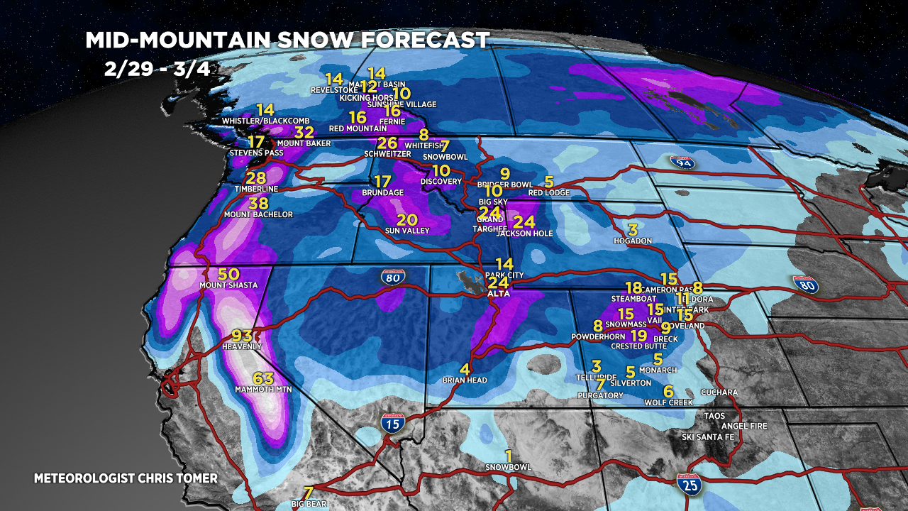
Timeline
Storm #1 Tapering-off Tetons/Wasatch, 2-3″ additional.
Colorado: 4-8″ Additional Today.
Wasatch Next Snow 3/2-3/4 (1-2FT+).
Tetons Next Snow 3/1-3/3 (2FT).
Storm #2 Is Major 2/29-3/4.
Sierra 4-8 Feet Late 2/29-3/3.
Current Setup
Water vapor satellite shows the current Robust Quick Strike storm system over Colorado/WY/UT.
Storm #2 is waiting in the Gulf of Alaska.
Orange/red = drier air aloft.

Forecast Radar & Satellite
Forecast Totals


Northeast:
VT/NH/ME rain 2/28 then rain/snow late 2/28 – early 2/29.
Snow chance late 3/6-3/7.
