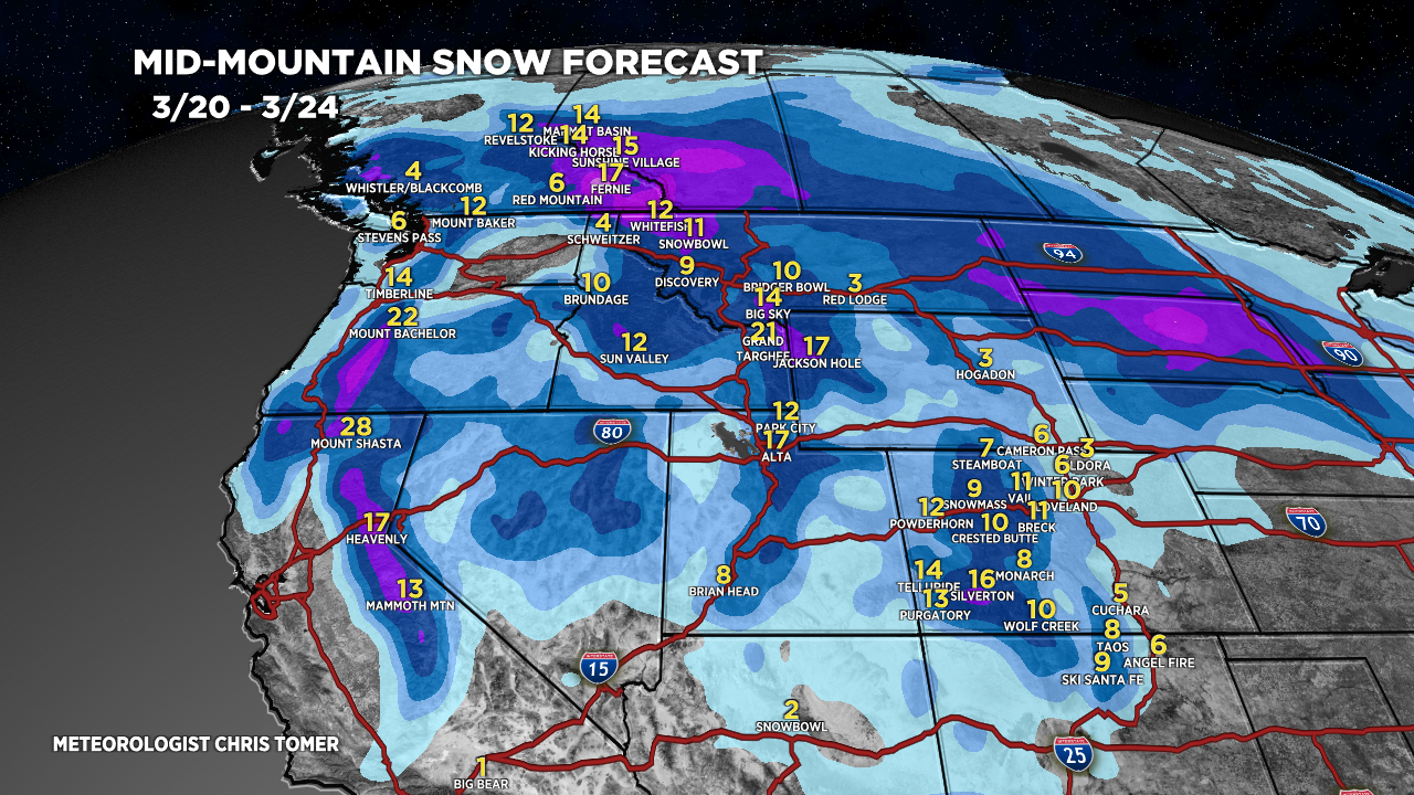
Tomer’s Take: The big Colorado storm system is sliding south and retrograding West where it will sit and spin for several days. Accumulation next 5 days occurs in Southern CO, NM, Southern UT, and AZ. It stays high and dry in the Central and Northern Rockies, PNW/BC through 3/19. Then the pattern shifts with a large storm system and powerful jet stream. Heavy snow accumulation possible 3/20-3/24 across BC/PNW/MT/ID/UT/WY/CO/CA.
Timing
Low Retrogrades and Spins.
Tetons: Next Storm System 3/21-3/24.
Wasatch: Next Storm System 3/21-3/24.
Colorado: Next Storm System 3/21-3/24.
Revelstoke: Next Storm System Late 3/20-3/23.
Northeast: Light Accum 3/18, 3/20, H 3/23.
My forecast video update:
Current Setup
Water vapor satellite shows the retrograding low pressure. The next storm system in the Pacific is part of the pattern shift on/after 3/20.
Orange/red = drier air aloft.

Forecast Radar & Satellite
Forecast Totals


Northeast:
Bulk of accumulation would occur on/about 3/23.

thanks again for the awesome and accurate reporting.
Can you share where I could find the total inches of moisture my back just shoveled? I know it was way more than the total inches reported by NOAA. It was constantly melting even when it was dumping snow. just wondering keep being awesome!
Hi Mercedes – I put a storm total liquid accumulation map in today’s Blog update. Chris