Tomer’s Take: An active week ahead with three separate cold fronts, 40 degree drop in air temps, strong wind, and heavy snow accumulation. Who’s affected? PNW, Banff, MT, ID, UT, WY, CO, CA.
Timing
Late 10/22 – 10/23: 1st Cold Front delivers snow to ID, WY, MT, Banff.
10/24-10/26: 2nd Cold Front delivers snow to PNW, ID, MT, WY, UT, Northern CA.
10/27-10/29: 3rd Cold Front delivers snow to CA, Southern ID, Southern MT, UT, WY, CO.
Current Setup
Notice the large, looming area of low pressure over the North Pacific. It’s a pattern changer and is accompanied by a large dip in the jet stream.

Forecast Jet Stream
Valid 10/25. Notice the dip in the PNW.

Valid 10/27:

Valid 10/29. The trough breaks loose and dives south spreading colder temps and snow accumulation through the Intermountain West. This is the best chance for snow in CO.

Forecast Radar & Satellite
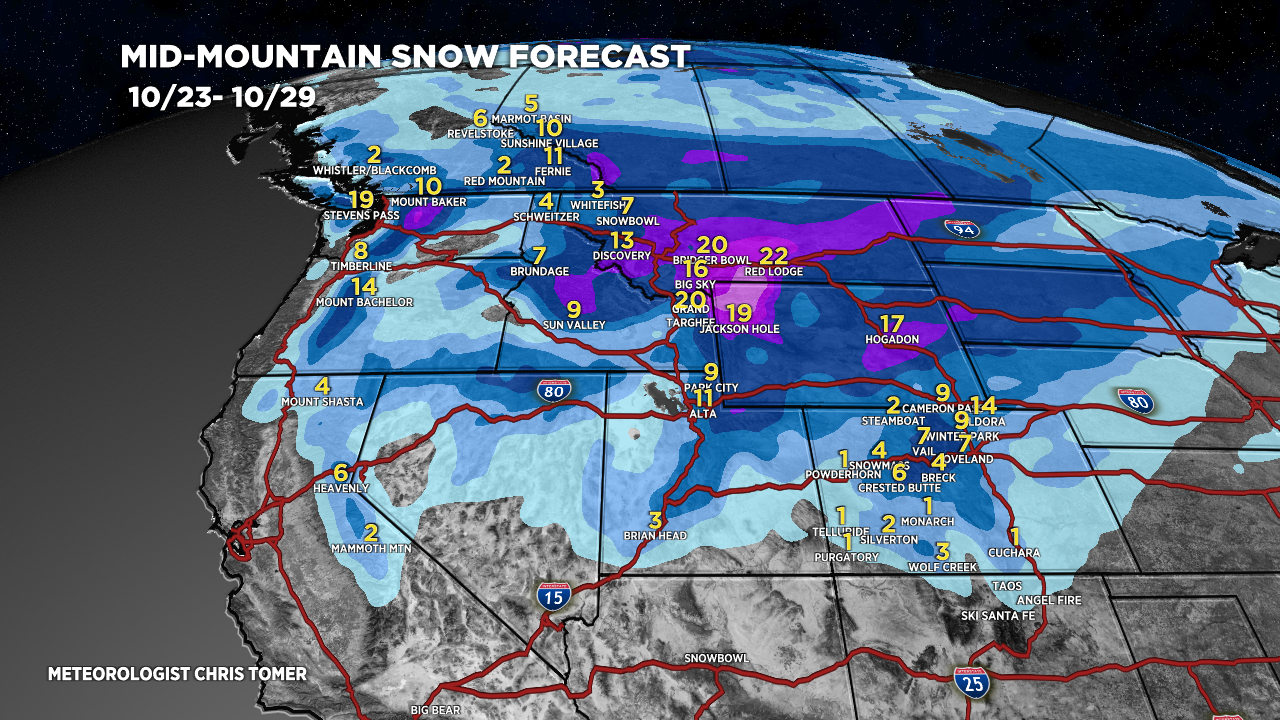
Forecast Snow Totals
Mid-mountain totals 10/23-10/27. I added Red Lodge Ski Area, MT.

10/28-10/29:

Examples
Tetons:
10/23: 1-2″
10/25: 10″
10/26: 6″
10/28: 1-3″
10/29: 1-3″
Alta/Snowbird:
10/23: 1-2″
10/25: 1-3″
10/26: 3-6″+
10/27: 1″
10/28: 3-6″+
10/29: 1″
Aspen/Snowmass:
10/28: 1″
10/29: 4-12″