Tomer’s Take: Atmospheric river continues in the PNW next 24 hours with high rain/snow levels. This storm system then breaks loose and races through the Intermountain West 12/7-12/8. A second minor, fast-moving storm system rides its coattails 12/9-12/10. A third feature is possible 12/12-12/13; A cold front dives south through CO and NM and might develop into a stronger area of low pressure.
In the Northeast, the Western storm system develops into a major area of low pressure on 12/10 that runs up the East coast with rain, thunderstorms, wind, and some snow. The NE ski resorts appear to be mainly rain.
Current Setup
Water vapor satellite shows an active Polar Jet and Atmospheric River (AR) component.
Orange/red = drier air aloft.

Forecast Jet Stream
Valid 12/6. Main energy remains in the PNW, but will break loose 12/7-12/8.
Forecast PNW rain/snow line ->
12/5: 7700′
12/6: 5000′
12/7: 4000′
12/8: 2500′

Valid 12/8. Notice the dip in the jet over WY, CO. An area of low pressure and cold front will drive south with snow.

Valid 12/14. An area of low pressure might develop in CO with snow to follow including NM.

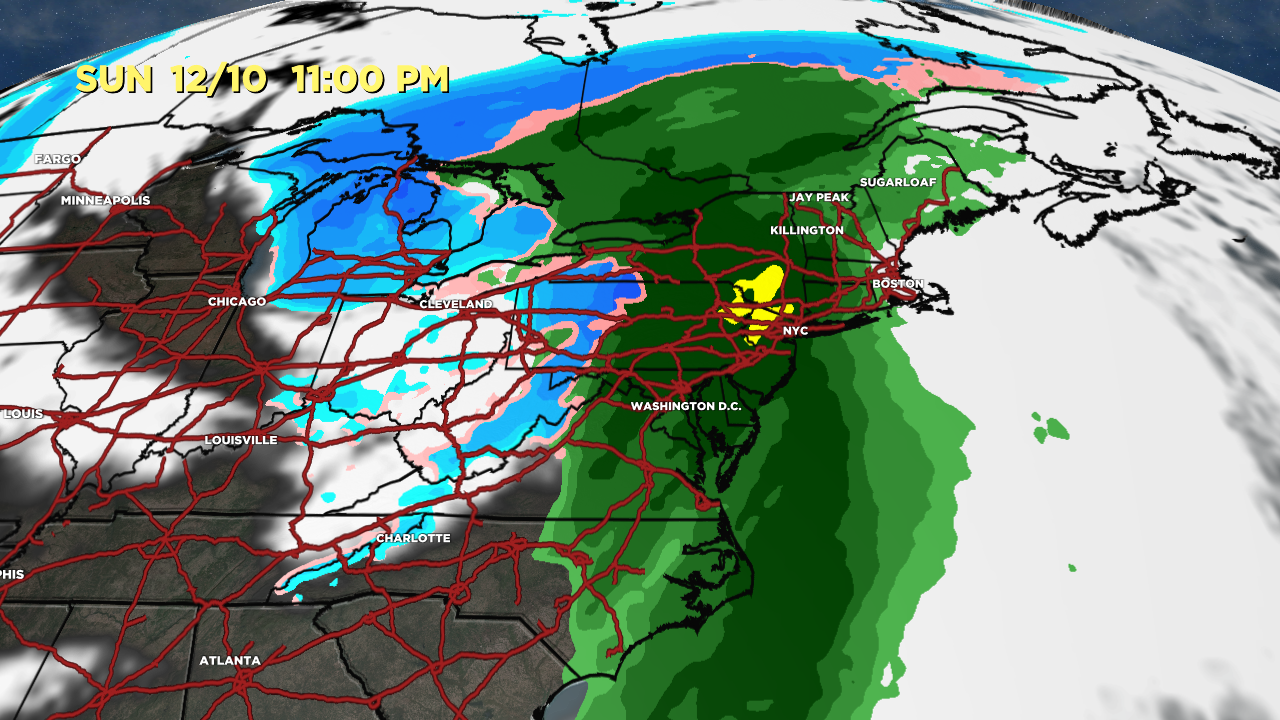
Eastern Storm System
Valid 12/10. Forecast radar & satellite shows mainly rain for the NE ski areas with snow on the colder side of the storm system. Also plan on thunderstorms and wind.

Valid 12/10. A powerful jet supports the area of low pressure, but the NE ski resorts are in the warm sector.

Forecast Radar & Satellite
Forecast Totals

CO Snow: 12/8, 12/10, 12/12, 12/14.
UT Snow: 12/7-12/8, 12/10.
WY Snow: 12/7-12/8, PM 12/9-12/10.


