Tomer’s Take: The warm & dry stretch for UT/WY/MT/ID/CO finally comes to an end after 1/5. The Polar Jet dives south from Canada with colder air and a storm system 1/6-1/8 with more widespread snow accumulation. Until then, we’re in what meteorologist Cory Gates calls ‘Closed Low Syndrome’.
My afternoon forecast video update:
Current Setup
Water vapor satellite shows three areas of low pressure lined-up in the Pacific with a West Coast trajectory.
Orange/red = drier air aloft.

Forecast Jet Stream
Valid 1/5. Notice the buckling Northern Branch and trough. This is the leading edge of colder Canadian air.

Valid 1/8. Pattern Change: A deep trough and area of low pressure move through UT/WY/CO/ID/MT along with colder air and snow accumulation.

Forecast Radar & Satellite
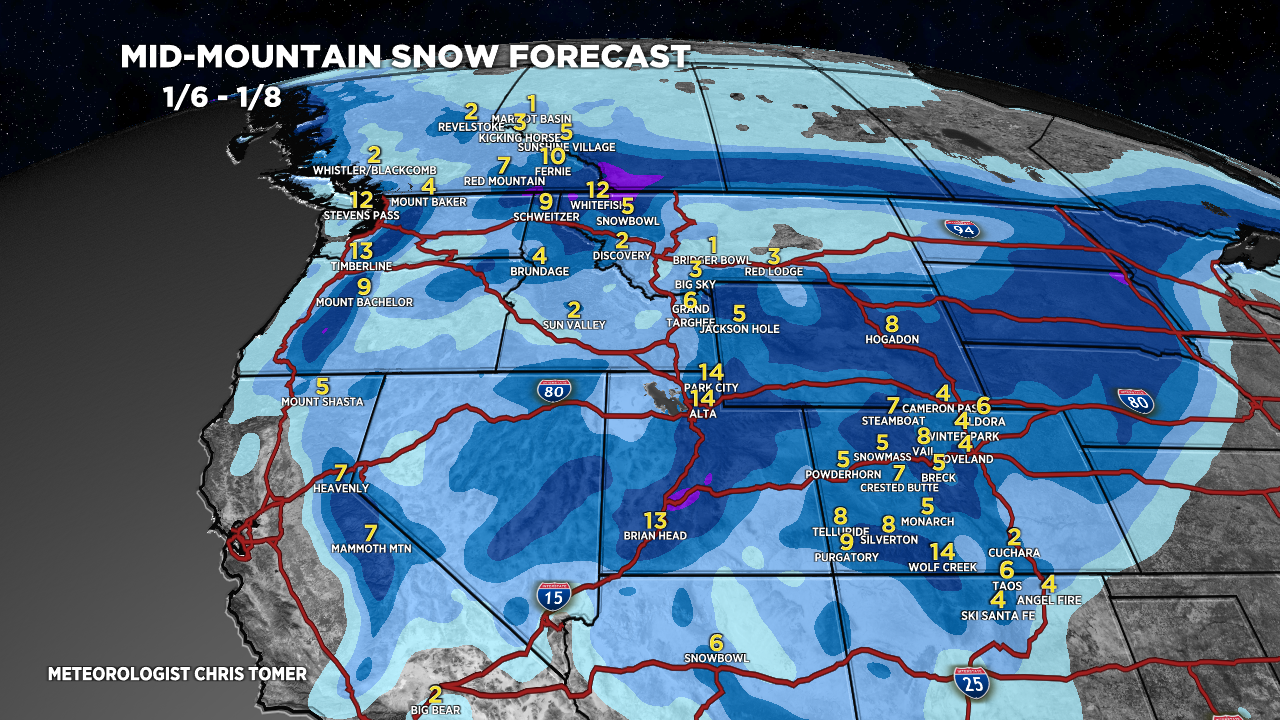
Forecast Totals

CA Snow: 1/3 & 1/6. Heaviest above 8,000ft.


Northeast: 99% of this accumulation occurs 12/30.

Hey Chris! What will this pattern shift mean for the Midwest ski areas and east coast ski areas? The lack of snow nationwide is pretty crazy. Thank you always for your wonderful forecasts!
Hi Jamie! The Northeast in particular could benefit from the Western pattern shift. Two strong areas of low pressure might emerge and track into the Northeast along with colder air and heavy snow. Chris