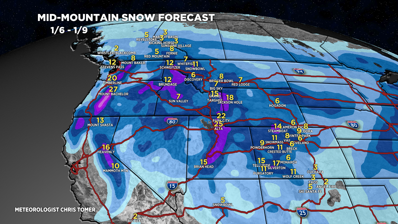
Tomer’s Take: Confidence is increasing for a significant Western pattern shift after 1/5. The key snow/cold window for UT/WY/ID/MT/CO is 1/6-1/9 with a two storm combo.
The Northeast might benefit from this Western pattern shift. For now, I’ll assume a perfect (best/worst case) setup and trim forecast in coming days.
My afternoon forecast video update:
Forecast Jet Stream
Valid 1/5. Here comes the pattern changing trough dropping south from AK/Canada into PNW.

Valid 1/8. Powerful jet, colder air, and energy sliding through Intermountain West.

Forecast Totals

CA Snow: Late 1/2-1/3, 1/6, 1/8.
Wasatch Snow: 1/6-1/9.
CO Snow: 1/4-1/5, late 1/6-1/9.
Teton Snow: Late 1/5-1/9.


Northeast best/worst case forecast assuming perfect ingredients.
VT/NH/ME Snow: 1/7, 1/9.
