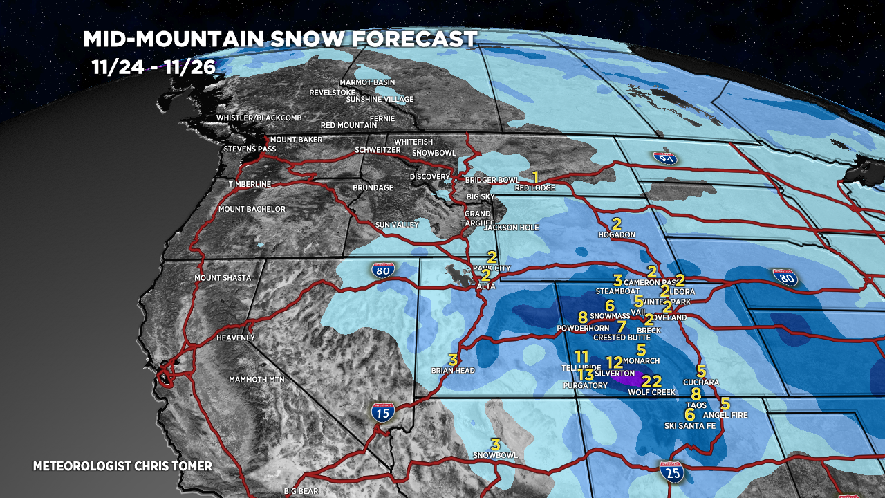
Tomer’s Take: Snow is moving out of UT & WY and into CO & NM with snow accumulation through 11/25. Then, the pattern shifts with high pressure ridging 11/26-11/29. The jet resets 11/30-12/5 with a stormier pattern and potential moisture loading on both jets.
My forecast video:
Forecast Radar & Satellite
Forecast Totals

Bulk of this accumulation occurs after after 11/29.
Both north and south jets become active 11/30-12/5.
