Tomer’s Take:
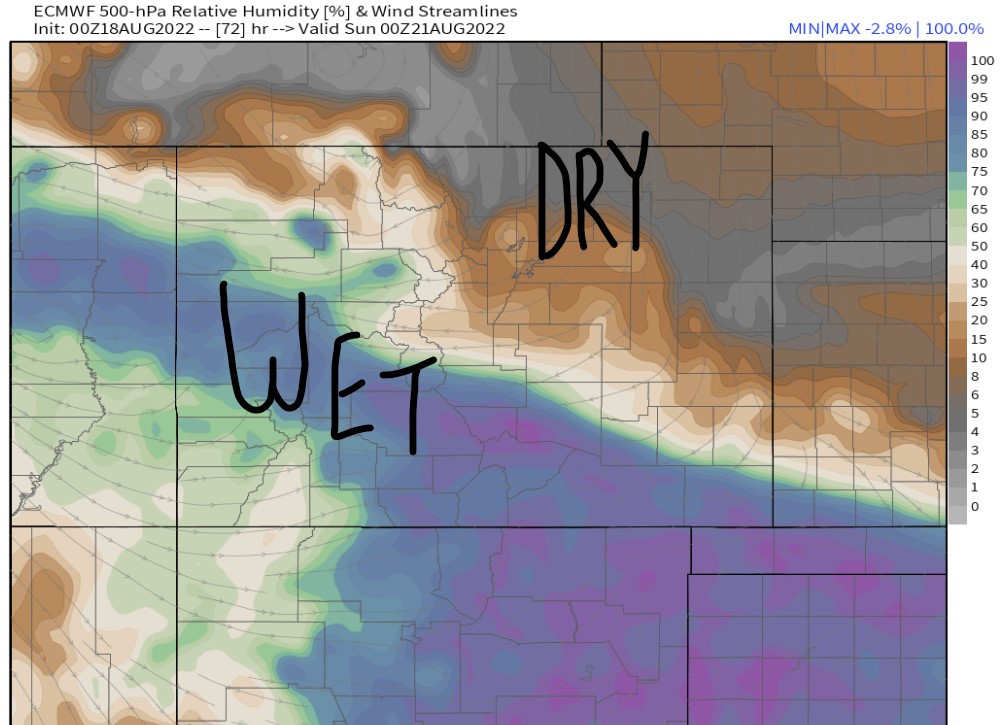
- A small Monsoon surge hits Colorado 8/19-8/22.
- Bulk of moisture stays in the Southern and Central Mountain Zones.
- LT100 run and Triple Bypass are 8/20.
Current Setup
Water vapor satellite shows a large wedge of drier air moving into Colorado. The next Monsoon plume is forming to our West in Arizona and Nevada. Orange/reds = drier air aloft.

Flash Flooding
Excessive rainfall outlook valid 8/18.

Excessive rainfall outlook valid 8/19.

Forecast
| Massive-Elbert | AM | PM |
| 8/18 | Dry | 10% |
| 8/19 | Dry | 80% |
| 8/20 | 10% | 80% |
| 8/21 | 10% | 60% |
| 8/22 | 10% | 60% |
Hourly forecast valid 8/20 in Leadville:
| 8/20 | 4am | 10am | Noon | 4pm | 9pm |
| % | Dry | 10% | 80% | 80% | 30% |
| Sky | Overcast | Cloudy | Storms | Storms | Clearing |
Triple Bypass valid 8/20
Air temps over Loveland Pass and Vail Pass (High/Low): 54°/31°F
| 8/20 | 4am | 10am | Noon | 4pm | 9pm |
| % | Dry | 10% | 70% | 70% | 20% |
| Sky | Overcast | Overcast | Storms | Storms | Clearing |
Both events on 8/20 straddle a sharp line between the Monson surge and drier air to the north. Mid-atmospheric relative humidity valid afternoon 8/20:

