Tomer’s Take: The next storm system and WNW Flow remains on-track for 1/17-1/18 delivering moderate to heavy snow in BC/WA/ID/MT/WY/UT/CO.
Looking down the road, a warmer Pacific flow pattern takes shape 1/19-1/25.
My afternoon forecast video update:
Season Totals

Crystal clear and cold in Vail, CO this morning after 3-4 feet of new snow in the last 7 days!
Current Setup
Water vapor satellite shows the next storm system and developing WNW Flow approaching the PNW/BC.
The larger area of low pressure and trough over the West Pacific is part of the warmer Pacific flow 1/19-1/25.
Orange/red = drier air aloft.

Forecast Jet Stream
Storm system + WNW Flow delivers moderate to heavy snow to BC/WA/ID/MT/UT/WY/CO 1/17-1/18.

Warmer Pacific flow pattern and strong Subtropical Jet. Expect waves of precipitation through the Interior Rockies. Higher snow levels.

Forecast Radar & Satellite
Forecast Totals
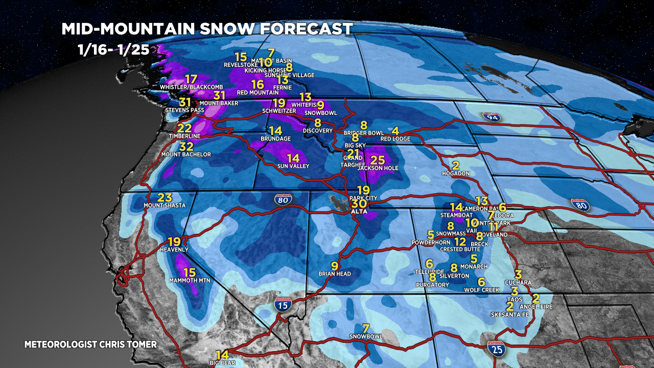
Grand Totals 1/16-1/25.


Northeast:
Moderate snow 1/16, Light snow 1/18, Moderate snow 1/24-1/25.
