Tomer’s Take: I’m forecasting three different storm systems through 11/22. Heavy snow appears likely. The first low originates in CA (where totals will be low) and tracks through UT, AZ, NM, and CO. This first trough greases the skids. The 2nd low races from the PNW through ID, MT, WY, UT, and CO to fill the void. The third low is a major storm system that nails the PNW and BC and then tracks through Banff, ID, MT, WY, UT, and CO.
Current Setup
Water vapor satellite shows a large trough of low pressure digging south towards the CA coast. Once upon a time this storm system looked like it might drop heavy snow in the Sierra. Not now. Why? Lack of atmospheric river contribution and trajectory. But, it will grease the skids for two additional storm systems in the PNW.

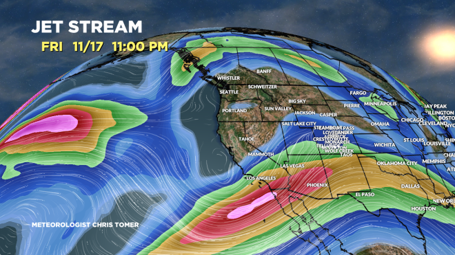
Forecast Jet Stream
Valid 11/17. First large tough slowly moving onshore into CA.
Valid 11/19. Powerful jet stream acting like a conveyor belt for two additional areas of low pressure. This WNW flow will guide heavy snow through PNW/BC, ID, MT, WY, UT, and CO.

Valid 11/22. Jet orientation after the 3rd and final low of this storm cycle. Low exits through CO.

Forecast Radar & Satellite
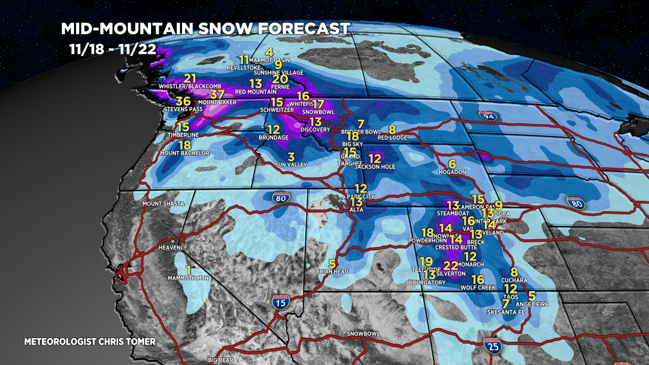
Forecast Snowfall
*Updated 4pm 11/13.

*Updated 4pm 11/13.

Windy Period 11/19-11/21
Max gusts (mph) –>
Kings Peak, UT
11/19: 50mph
11/20: 40mph
11/21: 55mph
Longs Peak, CO
11/19: 55mph
11/20: 50mph
11/21: 85mph
Quandary Peak, CO
11/19: 50mph
11/20: 50mph
11/21: 55mph
Mount Rainier, WA
11/19: 45mph
11/20: 85mph
11/21: 85mph