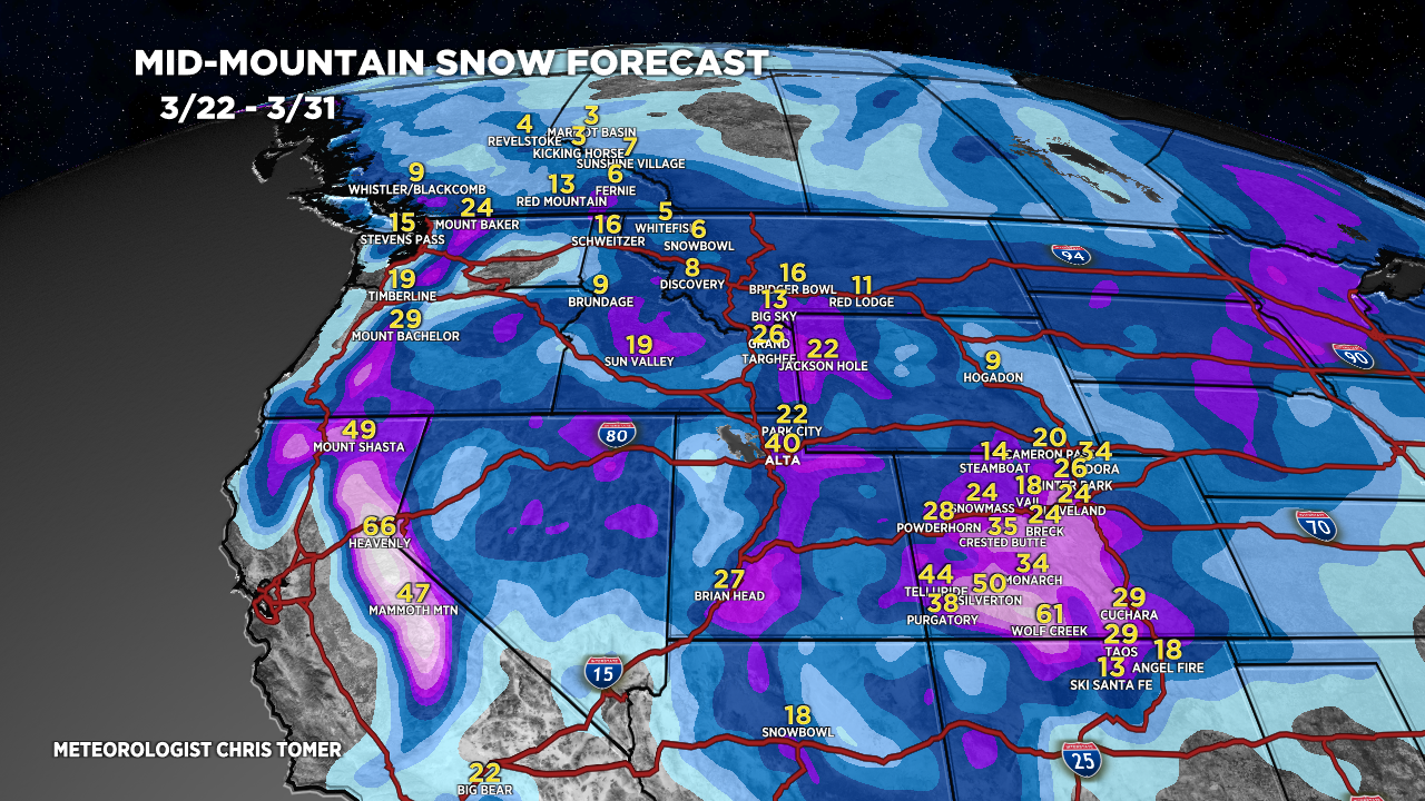
Tomer’s Take: I’m forecasting four different storm systems for the West through late 3/31 with feet of grand total accumulation.
Timeline
*Updated 4pm 3/22/2024.
Snow moving into the Sierra tonight through early 3/24.
Four Storm Systems Through 3/31.
Sierra: H Accum PM 3/22- AM 3/24, H 3/27-3/30.
Tetons: H Accum 3/23-3/24, L 3/26-3/27, H 3/28-3/31.
Wasatch: L PM 3/22, M/H Accum PM 3/23-3/26, H 3/28-3/31.
Colorado: H Accum PM 3/23-3/25, L 3/26, H PM 3/28-3/31.
Northeast: H Accum 3/23, L 3/27.
My afternoon forecast video update:
Current Setup
Water vapor satellite shows all four storm systems lined-up.
Orange/red = drier air aloft.

Forecast Radar & Satellite
Forecast Totals
Grand totals by late 3/31.


Northeast:
VT/NH/ME: Heavy accumulation 3/23, heavy 3/28.
