Tomer’s Take: It’s a powder day in UT/WY/CO! The next storm system hits the Sierra this afternoon then rolls towards the Four Corners with snow for UT/WY/CO/NM through 4/1. A pattern shift after 4/2 delivers 1-2 additional Canadian storm storm systems. The first week of April looks active.
Timing
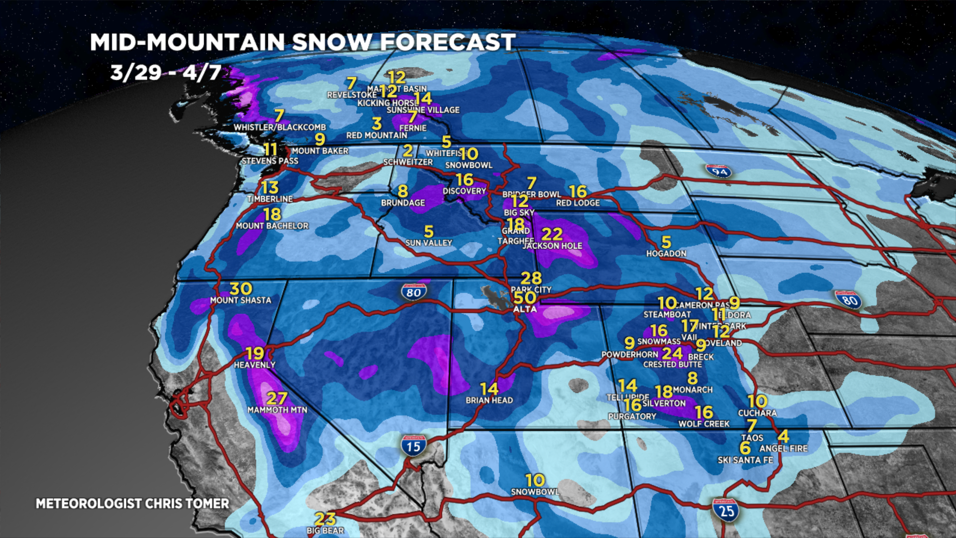
2-3 Storm Systems Through 4/7, Big Totals.
Wasatch: H PM 3/29-3/31, H 4/4-4/5.
Tetons: M 3/30, H 3/31, M/H 4/4-4/5.
Colorado: H 3/29, L 3/30, H 3/31, L 4/1, H PM 4/5-4/7.
Sierra: H PM 3/29-3/31, M 4/4-4/7.
Northeast: H 4/3-4/4.
My afternoon forecast video update:
Current Setup
Water vapor satellite shows the current storm system moving through CO and the larger trough approaching CA.
The other two storm systems in the Pacific move into Canada then drop south after 4/2 with a pattern shift.
Moisture aloft = white/blues.

Forecast Radar & Satellite
Forecast Totals
Grand totals by late 4/7.


Northeast:
Heavy snow potential 4/2-4/3.

Thank you!
Thanks, Beverly! Chris
Are the blog updates not being done anymore? I can only see up to March 29th. Thanks for the amazing page, Chris!
Seems that I’m not the only one experiencing that, Pasha. On YouTube I see Chris has posted some videos in April.
Hi Pasha & Brent – I usually stop doing regular ski/snow updates April 1 or shortly thereafter. Best, Chris