Tomer’s Take: Most places will feel the heat this week with abnormally warm Pacific air flooding the West. Snow levels jump significantly. Freezing levels run 6-9K in the PNW/BC and 8-11K in UT/CO. The first week of February still looks active with two different storm systems and progressively colder air. Widespread heavy snow accumulation possible.
My afternoon forecast video update:
Current Setup
Water vapor satellite shows a rich flow (Green Arrows) directed into the PNW/BC with high freezing levels through 1/31.
The big trough in the Pacific follows a strong Subtropical jet stream into the West on/after 2/1.
Orange/red = drier air aloft.

Forecast Jet Stream
Storm #1 rides a powerful Subtropical jet into CA then Intermountain West 2/1-2/5.

Storm #2 arrives 2/5-2/7.

Forecast Radar & Satellite
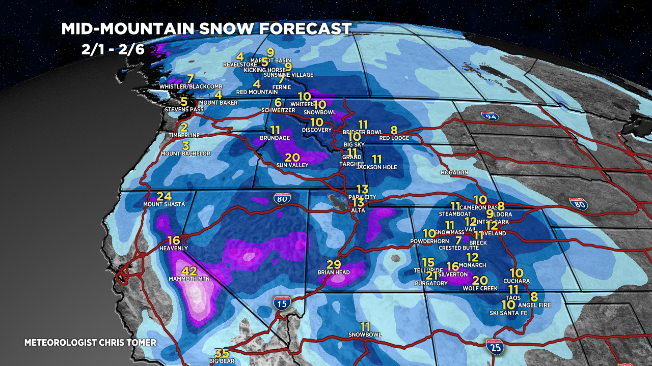
Forecast Totals


Northeast:
VT/NH/ME: Light to moderate snow accumulation PM 1/28-1/29, light accumulation 2/1-2/2.

I am a newbie on your site. I will say though, you’re killin’ it! The ski/weather nerd in me is most appreciative of your analysis. Thank you very much
Thanks, Daniel! Chris