Tomer’s Take: Light snow accumulation continues across VT/NH/ME into early 3/11. Out West, the stormtrack favors the PNW/BC/Northern Tier through 3/11 then the northern jet buckles south into UT/WY/CO 3/12-3/14 with moderate to heavy snow accumulation. The storm system strengthens in SE Colorado with enhanced snow accumulation on the Divide and across Southern Colorado. A large dome of high pressure builds into the PNW/BC 3/16-3/19.
Timing
*Updated 5pm 3/10/2024.
Revelstoke & Red Mountain: 8-10″ Now-3/12.
Tetons: Light Accum PM 3/11, M 3/12-3/13.
Wasatch: Light Accum PM 3/11, M 3/12-3/13.
Colorado Low Spins Up 3/13-3/15.
Colorado: Heav Accum 3/13, M 3/14, L 3/15.
Northeast: Light Accum into 3/11.
My afternoon forecast video update:
Current Setup
Water vapor satellite shows two storm systems riding the northern jet into the PNW/BC/Northern Tier through 3/11. Then the jet buckles south into UT/WY/CO 3/12-3/14.
Orange/red = drier air aloft.

Forecast Radar & Satellite
Forecast Totals
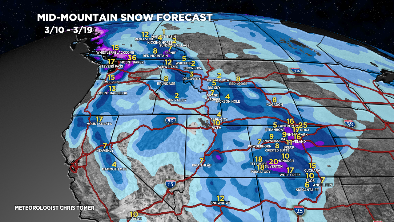
Grand totals by late 3/19.


