Tomer’s Take: Snow in the Wasatch and Colorado ends tonight with another 1-3 inches in the Tetons. The next storm system arrives 2/19-2/22 in UT/CO/ID/WY with moderate to heavy snow accumulation. Big totals possible 2/25-2/28 with northern jet involvement and energy.
My afternoon forecast video update:
Current Setup
Water vapor satellite shows a large trough of low pressure sending waves of energy into the Intermountain West. The entire trough moves into CA 2/19-2/20 with heavy snow accumulation across the Sierra. Then it hits UT/ID/WY/CO 2/20-2/22.
Orange/red = drier air aloft.

Forecast Jet Stream
Forecast Radar & Satellite
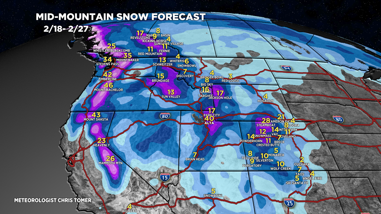
Forecast Totals
Grand totals by late 2/27.


Northeast:
VT/NH/ME light snow accumulation PM 2/22-2/23. Another storm system around 2/27.

Fading El Nino
BTW, EL Nino is fading quickly. We’re officially under a “La Nina Watch”. Neutral conditions by May and La Nina by Summer.
This will slowly shift the pattern for the Western United States. I think we’ll still have a solid March across UT/ID/WY/CO.
Colder values represent La Nina.

Chris, what does is look like for Sunshine and Lake Louise 2/25 -3/1, please?
Hi Teena –
The pattern does seem to support snow accumulation 2/25-3/1. I’ll be able to forecast amounts tomorrow. Chris