Tomer’s Take: Snow continues in the Sierra this morning then drier this afternoon until the next storm system 1/24. This storm system then moves into UT/ID/MT/WY/CO/NM 1/24-1/26 with light to moderate snow accumulation. A warmer, drier period with high pressure builds over the Intermountain West 1/27-1/31.
My forecast update video:
Current Setup
Water vapor satellite shows the current storm system hitting the West Coast. It splits and becomes a southern track storm system.
The 2nd storm system in the Pacific becomes the 1/24-1/26 UT/WY/MT/ID/CO/NM area of low pressure.

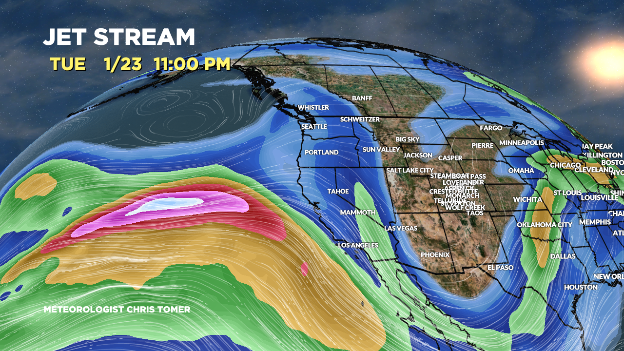
Forecast Jet Stream
Trough with southern track storm system sliding through the Four Corners.

2nd storm system and trough moving through UT/ID/MT/WY/CO/NM.

High pressure ridging over the Intermountain Rockies. Subtropical jet reloads for early Februray.

Forecast Radar & Satellite
Forecast Totals


Hi Chris,
Thank you so much for the daily updates!
Do you foresee the continuation of closed low syndrome during the next few weeks?
Hi Freddy, I think we’re stuck with the syndrome until at least 2/1. Then the pattern might shift. Chris
Chris-
You are a fabulous resource! However, for us skiers, storm cycle precip means if it’s not snow! Would greatly appreciate commentary and predictions on TEMPERATURE…many resorts (Bachelor, Palisades, Alta) showing rain/mist/fog in this cycle from what I can tell…so sub-par conditions. I’m new to OnTheSnow so I appreciate whatever guidance you can provide. Thx!
Thanks, Rich! I included forecast PNW rain/snow line in today’s update. Chris