Tomer’s Take: Storm #1 continues into 1/8 and then exits CO/NM. Storm #2 arrives 1/9-1/11. Storm #3 is the most interesting and most significant with Arctic air, robust jet support, high snow ratios, and big accumulation. Feet of grand total accumulation across most mountain ranges by 1/16. The Wasatch totals with storm #3 are trending up, and the Teton Range is split.
In the Northeast, the next storm system arrives 1/9-1/10, and storm #3 1/12-1/13.
My afternoon video forecast update:
Current Setup
Storm #1 moves through CO/WY/UT/NM and departs CO/NM afternoon 1/8.
Storm #2 follows storm #1. Storm #3 is lurking.
Orange/red = drier air aloft.

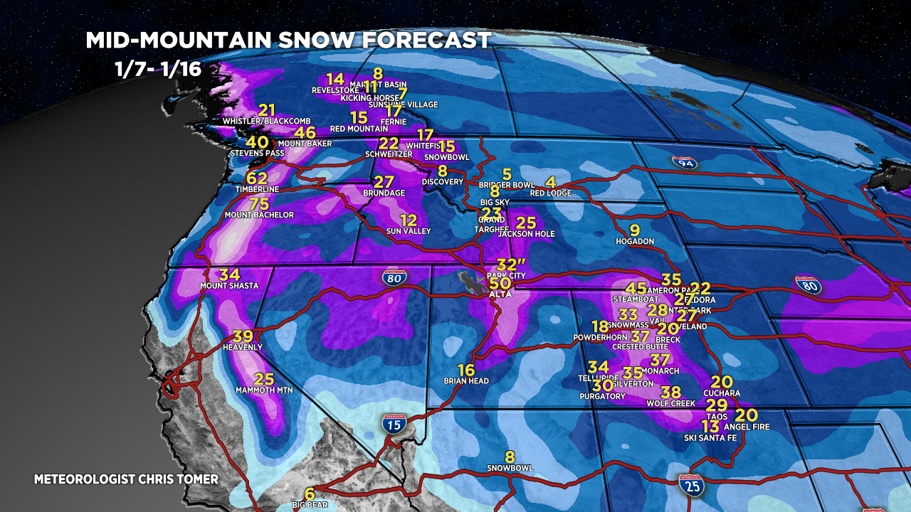
Forecast Totals
Grand Totals 1/7-1/16. Storm #3 1/12-1/14 generates biggest snow totals.

Storm #1.

Storm #2.

Storm #3. Confidence is lowest with storm #3.
Wasatch totals are trending up.
Teton totals are split. It’s possible that once the Arctic front blows through that snow accumulation tapers off.

Northeast, next storm system 1/9-1/10 with 70mph gusts and heavy snow changing over to rain/snow or rain in VT/NH/ME.
Another storm system 1/12-1/13 with moderate to heavy snow accumulation.

as always thanks for the report. snow shovel handy here in gunnison. We have been having cold dry weather. Humid today so maybe snow manana. Bill Nesbitt
Thanks, Bill! Chris
I’ve just discovered you and I appreciate the insight. Cheers !
Thanks, Daniel! Chris
Love these special twice daily updates – there’s just never enough when it looks this good – thanks Chris!
Thanks, Brian! Chris