Tomer’s Take: A Canadian cold front is diving south through WY into UT, CO and NM 11/23-11/25. Forecast snow totals are down slightly (-15%), but snow ratios remain high with much colder air. Then it’s a drier stretch with high pressure ridging 11/26-11/30. Pattern might turn stormier after 12/1 as jet resets.
My forecast video:
Current Setup
Water vapor satellite shows the Canadian cold front diving south.
Orange/red = drier air aloft.

Forecast Jet Stream
Valid 11/24. Door is wide open for colder air to plunge south through MT, WY, UT, CO, NM.

Valid 12/2. After high pressure ridging 11/26-11/30, the jet resets and turns more active for the West on/after 12/1.

Forecast Radar & Satellite
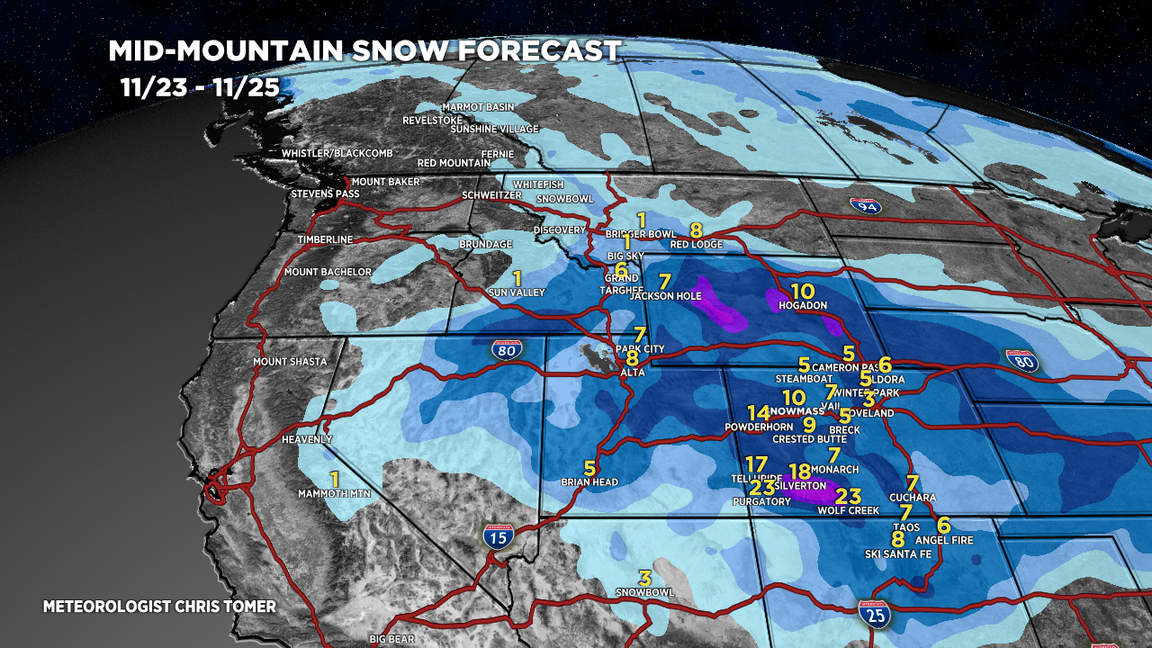
Forecast Snow Totals
Forecast totals are down slightly but ratios remain high with much colder air.

