Tomer’s Take:
- A minor storm system is spinning through the Intermountain West this morning with rain and snow.
- A larger storm system and dip in the jet stream is waiting in the Gulf of Alaska. This will drive the pattern across the West between 5/8-5/15. Some places get snow while others get mainly wind.
- The bulk of snow 5/8-5/15 falls in CA, ID, MT, WY, and northern UT.
Infrared satellite shows the storm track and large low pressure in the Gulf of Alaska.

A large dip in the jet stream and atmospheric pressure anomalies occur across the West 5/8-5/15.

Wind Gust Forecast
| Forecast (MPH) | 5/8 | 5/9 | 5/10 | 5/11 |
| Crestone Needle | 60 | 75 | 75 | 75 |
| Quandary Peak | 45 | 60 | 40 | 55 |
| Mount Sneffels | 65 | 75 | 70 | 75 |
| Kings Peak | 65 | 60 | 55 | 55 |
| Wheeler Peak | 55 | 60 | 50 | 50 |
| Mount Whitney | 80 | 55 | 30 | 35 |
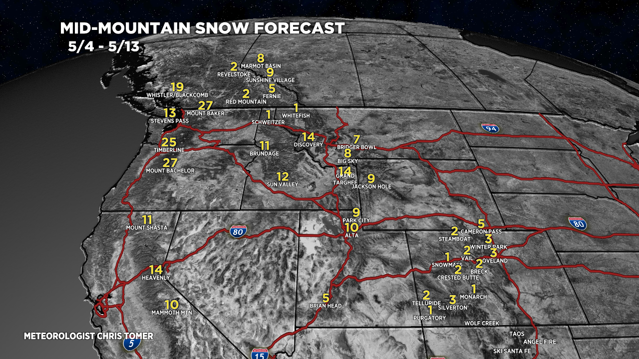
Snow Forecast
5/4-5/13:

Chris- what our your thoughts of winds on Humphreys peak? We are flying from out east to climb it Tuesday 5/10 but may have to modify our plans a bit to climb it later in the week
Hi Jon – are we talking about Humphrey’s Peak in Arizona?
Summit gusts:
5/9: 70mph
5/10: 50mph
5/11: 60mph
Chris