Tomer’s Take: Rain/snow hits California 12/18-12/20 with a rain/snow line 9k-10k (heavy snow above that level). Then two pieces of energy might merge over CO/NM for moderate to heavy snow accumulation 12/23-12/24. This setup leaves UT and WY with lighter snow accumulation.
Looking down the road, a more active storm track is possible for New Year’s into January 2024.
My afternoon forecast video:
Current Setup
Water vapor satellite shows the trough hitting CA and blasting the West with abnormally warm air. The two areas of low pressure in the North Pacific are important players 12/23-12/24 across the Interior Rockies.
Orange/red = drier air aloft.

Forecast Jet Stream
Valid 12/24 11pm. A trough is forecast over the Intermountain West including WY/UT/CO/NM supporting an area of low pressure and colder air.

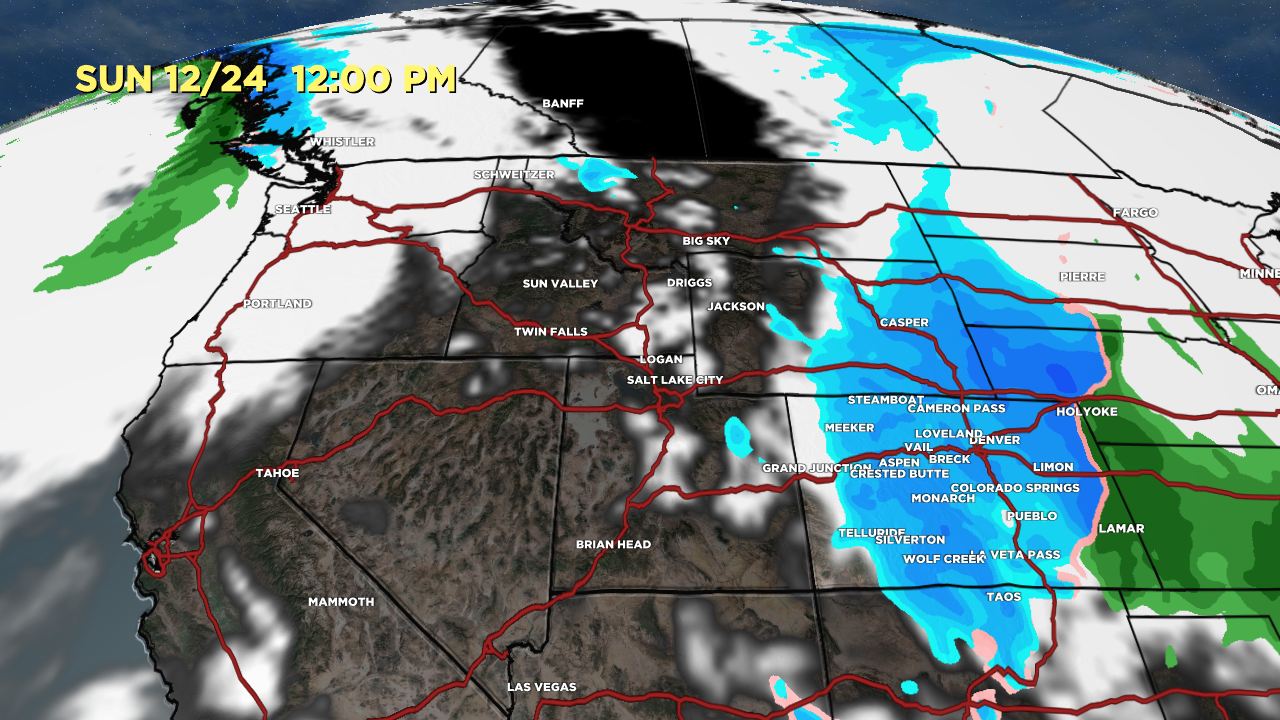
Christmas Forecast
Valid 12/24 12pm. Snow is possible in CO down to 5280′.

Christmas Morning. Storm system departs CO/NM.

Early to Mid January Storm Track
The NCEP Climate Forecast System hints at a more active storm track for the West.

Forecast Totals
*Updated 2:45pm 12/18.
CA bulk of snow above 9-10k.

*Updated 2:45pm 12/18.
UT Snow: 12/20, 12/22-12/23.
WY Snow: 12/23.
CO/NM Snow: 12/23-12/24.


What role is the strong El Niño playing in the roller coaster snow levels?
I noticed that earlier in December ski areas in the Pacific Northwest got a series of big snowstorms followed immediately by heavy rain events that washed away their snow bases.
Hi Grog – It’s keeping the West warmer than normal with a strong Pacific airmass influence. Pattern turns more active around New Years through January 2024.
Chris