Tomer’s Take: A challenging dry stretch ahead for the Intermountain Rockies including UT/WY/MT/ID/CO through 1/5. After 1/5 a pattern change is possible. Before 1/5 the storm track favors the West Coast including British Columbia/WA/OR/CA.
My afternoon forecast video update:
Current Setup
Water vapor satellite shows an active Pacific storm track with West Coast/BC trajectory.
Orange/red = drier air aloft.
Very little of this moisture survives the trip beyond the West Coast.

Forecast Jet Stream
Valid 1/3. Trough of low pressure rolls through CA/West Coast.

Valid 1/6. Another trough moves through CA/West Coast and into the Interior Rockies. I like the position of the Northern Branch and this could mean more of a pattern shift with colder air.

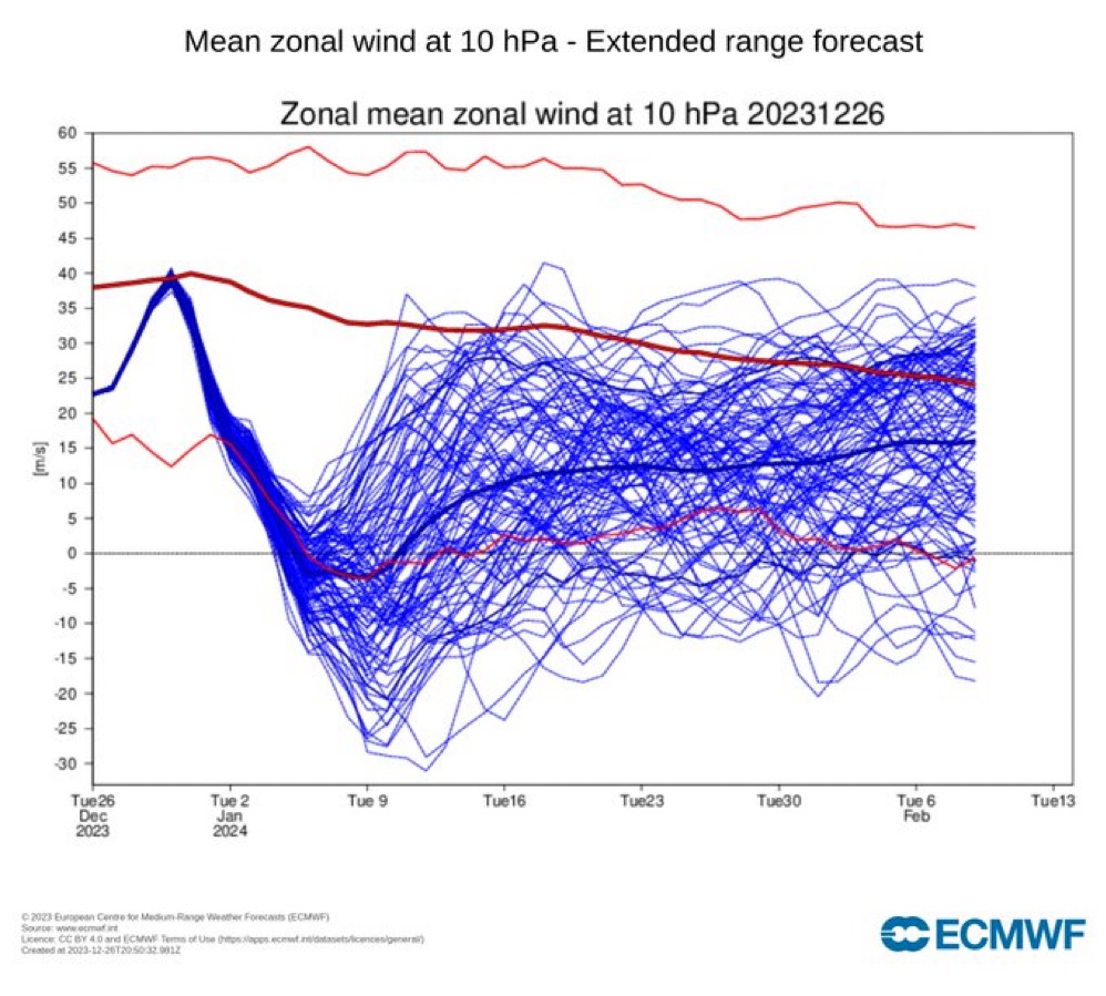
Stratospheric Warming
We look for clues in the Stratosphere as to what might occur in the Troposphere (lowest part of the atmosphere where we live). This is a macro forecasting tool.
One indicator shows warming in the Stratosphere in 10-15 days. This suggests a shift of the vortex over the North Pole. This can mean colder air is released and rotates south into the Lower 48.
Below, the forecast graphic from the ECMWF points to a shift in the Polar Vortex in 10-15 days. This *might* indicate a cold blast for the Lower 48.

Forecast Radar & Satellite
Forecast Totals


VT/NH/ME rain 12/28-12/29, changing to light snow 12/30.
