Tomer’s Take: A storm system delivers snow to UT/WY/ID/MT/CO/NM 1/25-1/26. Then brief high pressure builds over UT/WY/CO/NM 1/27-1/31 with warm, dry conditions. During this time, precipitation continues hitting the West Coast/PNW with a high rain/snow line. Then the flood gates might open the first week of February with a powerful Subtropical jet stream and deep trough of low pressure.
My afternoon forecast video update:
Utah: Year To Date Snowfall. One year ago Alta was at 436 inches.

Current Setup
Water vapor satellite shows the next storm system that hits UT/WY/ID/MT/CO/NM 1/25-1/26.
The 2nd area of low pressure spins north and becomes part of the early February pattern shift.
Orange/red = drier air aloft.

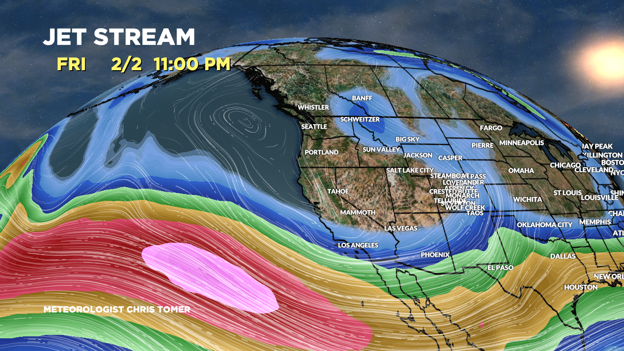
Forecast Jet Stream
Trough with storm system sliding through UT/WY/ID/MT/CO/NM.

Brief high pressure ridge over UT/WY/CO/NM.

First Week of February
Large trough of low pressure and strong Subtropical jet stream with heavy overrunning rain/snow.

Valid 2/3/2024. Forecast atmospheric pressure anomalies at about 18,000ft. Notice the large trough moving into the West.

Forecast Radar & Satellite
Forecast Totals


Northeast:
Rain on 1/25-1/26.
Storms to watch with snow: 1/28-1/29, 2/1.
