Tomer’s Take: Storm #1 exits CO/NM later today (1/8). Storm #2 dives south into the West 1/9-1/11. Storm #3 arrives 1/12-1/15 with an Arctic front.
In the Northeast, the next storm system arrives 1/9-1/10 followed by another storm system 1/12-1/13. A third storm system is possible on 1/17.
My afternoon forecast video update:
Wolf Creek, CO got nailed with 21 inches in 24 hours & 29 inches in 48 hours.

Current Setup
Water vapor satellite shows storm #1 exiting CO/NM. Storm #2 is poised in the north Pacific/AK/Canada.
Orange/red = drier air aloft.

Forecast Jet Stream
Storm #2 diving south into PNW then Intermountain West.

Storm #3 and Arctic front colliding over the West.

Storm #3 sliding through UT/CO/WY/NM.

Forecast Radar & Satellite
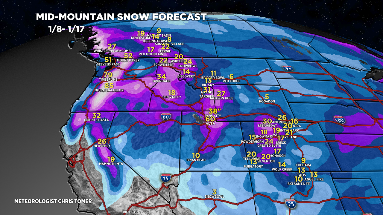
Forecast Totals
Grand Totals from storm #2 + storm #3.

Storm #2.

Storm #3.

Northeast Grand Totals from next 2-3 storm systems.
Next storm system 1/9-1/10 hits with 70mph gusts and heavy snow changing to rain/snow or rain all all major ski areas.

Thanks Chris!
Where do we send gifts?
🙂
Thanks, Paul! Chris
Hi Chris- I love your forecasts but wondering if you could add the Midwest to these. With the passing of John Dee, we are missing thorough and accurate forecasts for north Wisconsin, Minnesota, and upper peninsula. Looking for a good forecast for local skiing and snowmobiling.
Thanks for the note, Jennifer! Chris