Tomer’s Take: Two storm systems are lined-up through 4/2 then a pattern shift occurs with a third storm system dropping south from Canada with heavy snow accumulation.
Timing
Two Storm Systems Through 4/2 Then Shift North.
Third Storm System Trending Stronger 4/3-4/6.
Sierra: H Tonight – AM 3/28, H PM 3/29-3/31.
Tetons: H 3/28, L 3/30, H 3/31, H 4/3-4/5.
Wasatch: M/H 3/28, H PM 3/29-3/31, H 4/4-4/5.
Colorado: H 3/29-4/1, H 4/5.
Northeast: L 3/27, H 4/2-4/4.
My forecast update video:
Current Setup
Water vapor satellite shows the first two areas of low pressure lined-up through 4/2.
Orange/red = drier air aloft.

Forecast Radar & Satellite
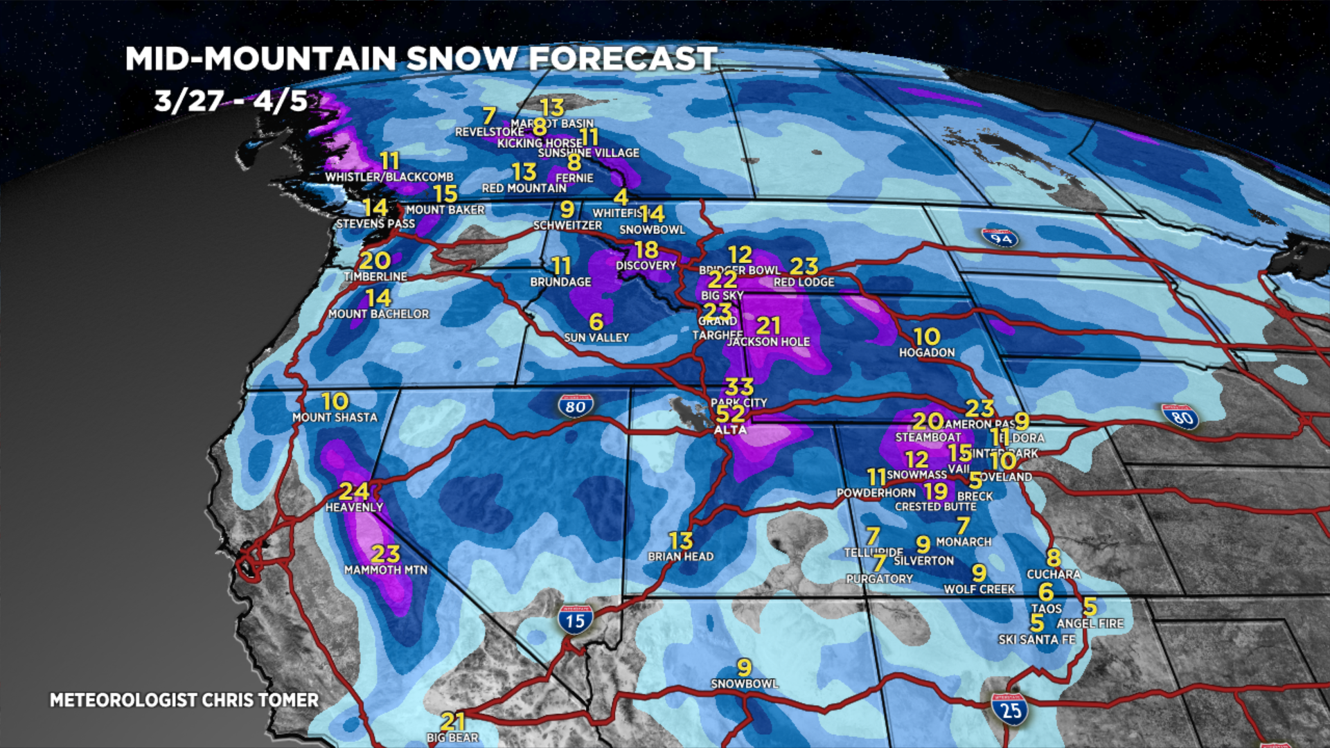
Forecast Totals
Grand totals by late 4/5.


Northeast:
This assumes temperatures on 4/2-4/4 are cold enough to support snow.
