Tomer’s Take: Heavy snow likely this weekend in CA/ID/WY/UT/CO with feet of accumulation. Strong ridgetop winds of 40-80mph. Additional moderate to heavy snow accumulation 3/5-3/9 with two storm systems.
Timing
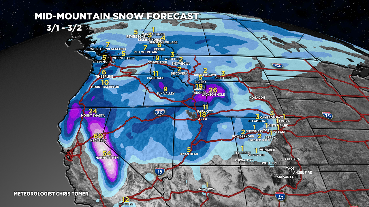
*Updated 3/1 4pm.
Wasatch Light Tonight, Heavy PM 3/2, L/M 3/3.
Tetons Heavy Tonight-3/2, L/M 3/3-3/4, H 3/5.
Colorado Heavy PM 3/2-3/3, L 3/5.
Sierra 5-10 Feet Now – AM 3/3, H PM 3/4-3/6.
Powder Highway, Canada 3-8″ Now – AM 3/3.
Northeast Mainly Rain Until 3/7-3/8.
My forecast video update:
Current Setup
Water vapor satellite shows the big storm system hitting CA with 4-8 feet of snow accumulation and blizzard conditions. Next stop is UT/CO/WY.
Red/orange = drier air aloft.

Forecast Radar & Satellite
Forecast Totals


