Tomer’s Take: The next western storm system hits 11/22-11/25 in MT, UT, WY, CO, and NM. It delivers much colder air and higher snow ratios. Then, the pattern shifts with a much drier stretch through 11/30 and high pressure ridging. Stormier pattern might develop on/after 12/1 as jet stream resets.
Snow continues today across the higher elevations of VT, NH, and ME.
My forecast video:
You can see the problem at Jackson Hole, 11/22 @7am. The snow line is halfway up the mountain. We need colder air to drop the rain/snow line down to the valley floor. The next cold front will do just that with much colder air on/after 11/23.

Current Setup
Water vapor satellite shows the lurking Canadian cold front. It dives south through MT on 11/22.
Orange/red = drier air aloft.

Forecast Jet Stream
Canadian cold front dives south through UT & CO into NM.

Drier period 11/26-11/30 with high pressure ridging. Pattern turns stormier on/after 12/1 as jet resets.

Forecast Radar & Satellite
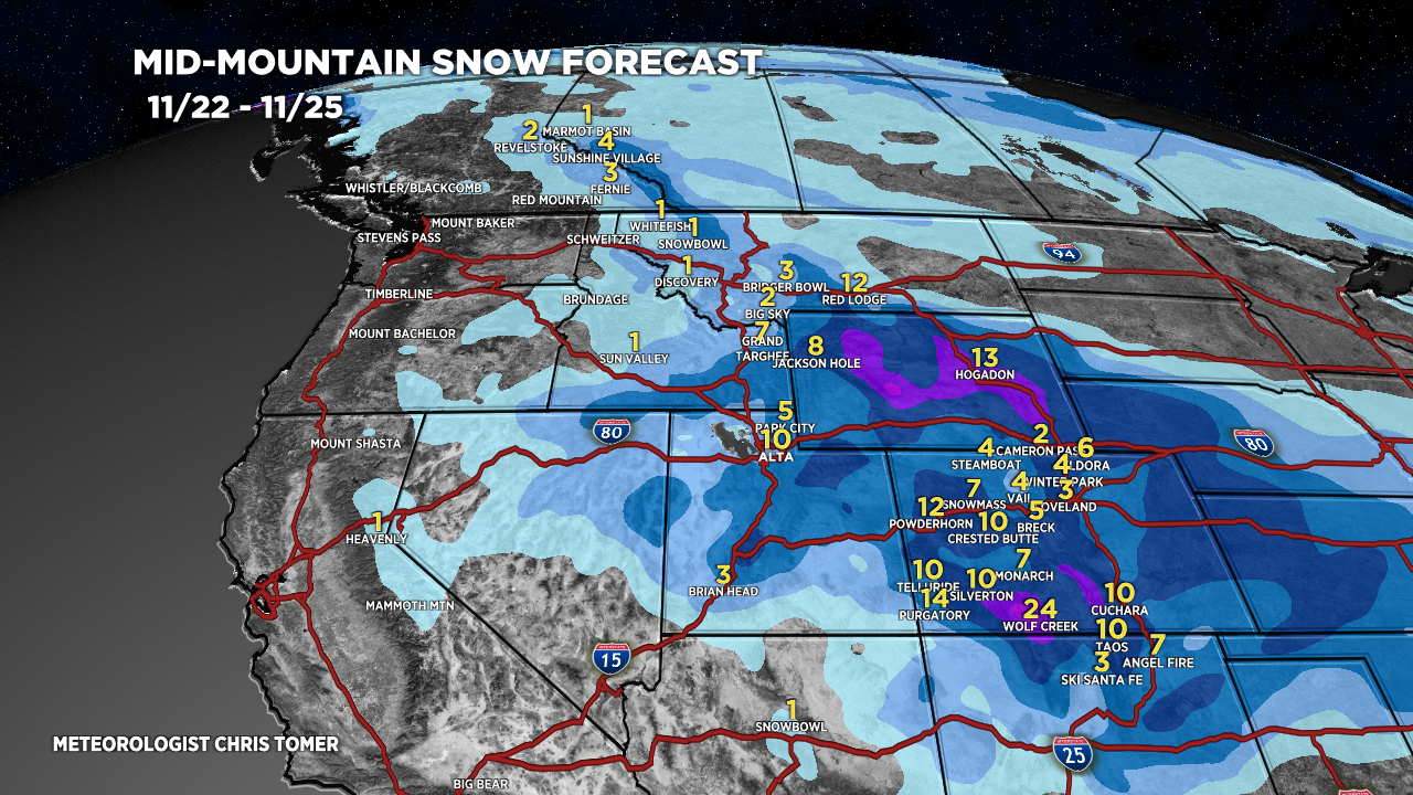
Forecast Snow Totals
*Updated 4pm 11/22.
MT Snow: 11/22-11/23.
WY Snow: 11/23.
UT Snow: PM 11/23-11/24.
CO Snow: Late 11/23, 11/24, 11/25.
NM Snow: PM 11/24-11/25.

*Updated 4pm 11/22.
Much drier 11/26-11/30. Pattern starts to shift on/around 12/1 with snow developing in CA.

Happy holidays to you and yours!
Thanks, Brad!